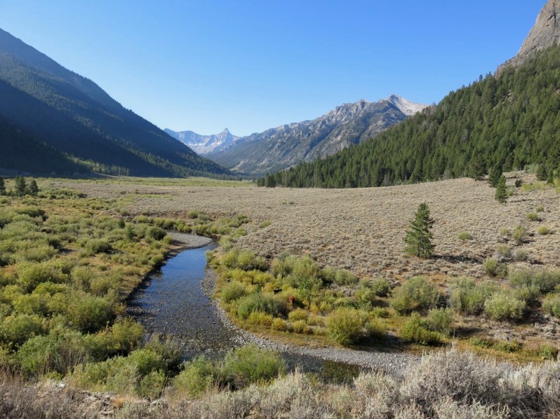
Central Idaho’s Wildhorse Canyon lies about 20 miles NE of the famous resort town of Sun Valley. With its headwaters in the 12,000’+ peaks of the Pioneer Mountains, Wildhorse Creek joins the Big Lost River, which then flows about 60 miles before disappearing into the porous lava fields of the Snake River Plain. Well, at least in the old days it did. Now it disappears even sooner into irrigation canals and alfalfa fields.
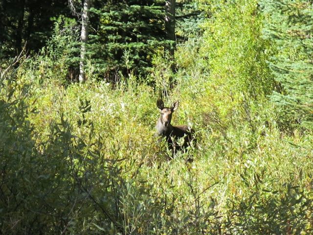
Moose try to be secretive. But their big ears are a sure giveaway.
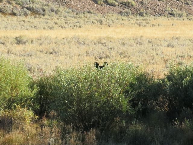
I didn’t see a moose until I was in my 30’s. I had always imagined them wading belly deep in swamps. But the moose of Idaho have ruined that mental image.
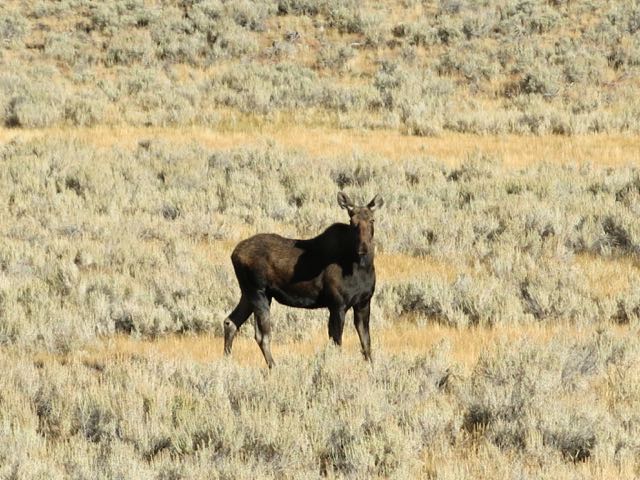
Maybe they dream of boggy Maine and Alaska while ambling through sagebrush and rock slides here in the lower part of the canyon.
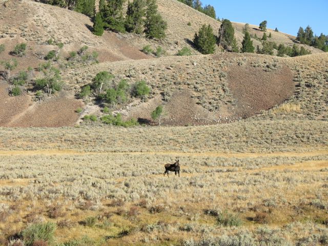
This one looks more at home in the forested upper canyon.
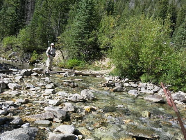
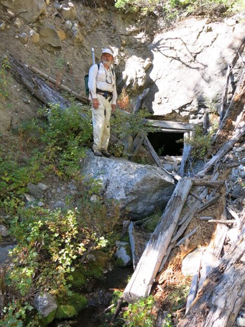
Near the end of the road, Janene and I set off to locate the nearby Wildhorse Mine.
Getting there requires a stream crossing. Janene considers all stream crossing a perilous disaster in the waiting, so I wait as she stalls by taking photos.
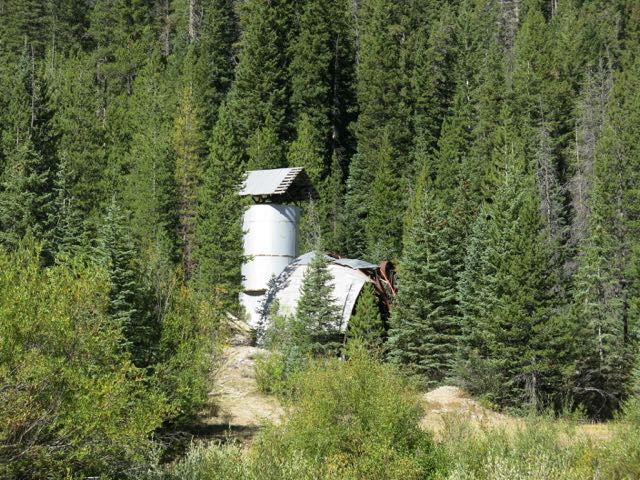
In 1953 prospectors found tungsten ore here. The following year this mill was built to crush and concentrate the ore. From 1954-56 the mine and mill employed a half dozen workers, and produced only enough concentrated ore to fill about 5 of today’s standard dump trucks.
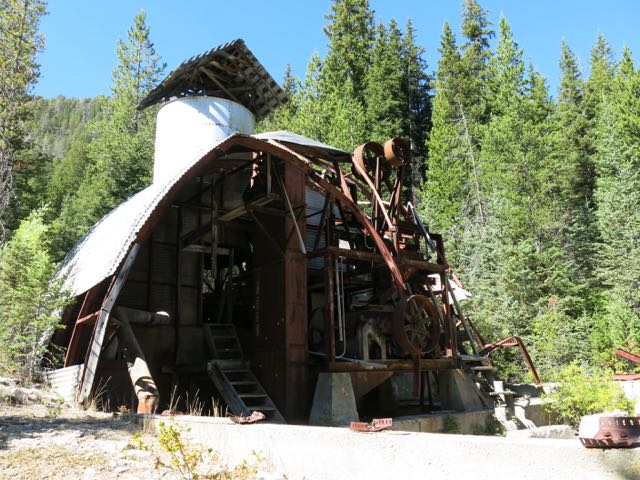
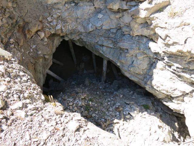
But tungsten was considered a strategic mineral, and the Cold War was in full swing. So in 1957 the US Government helped fund further exploration. This addit is one of several on the side of the valley. “Adit” is the mining term for an entrance to a horizontal tunnel. A “shaft” is vertical. By the end of the exploration the mine complex had a couple thousand feet of tunnels. I choose not to crawl in and explore. Janene chose to not get any closer than needed to take this picture.
Most of the ore came from this open pit and nearby tunnels in the first years of operation. But the government funding and further exploration did not find any economically viable deposits, and the mine ceased operations. More drilling and testing were done in the early 1980’s, but no mining has taken place since 1956.
But I was here to search for trout, not mineral wealth. So on up the steep valley slope we climbed. Along the way we ran across numerous mining claim markers from back in the 50’s. To each metal stake was attached a wooden block, on which was mounted a baby food- sized jar lid and a metal tag. Inscribed on the tag was information about the claim.
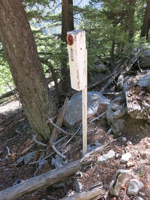
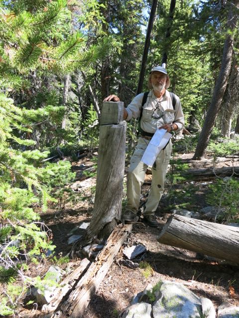
Not sure what they were for, but we found a couple of these squared off tree stumps. Could this be an older style of claim marker, pre-dating the era of baby food jars?
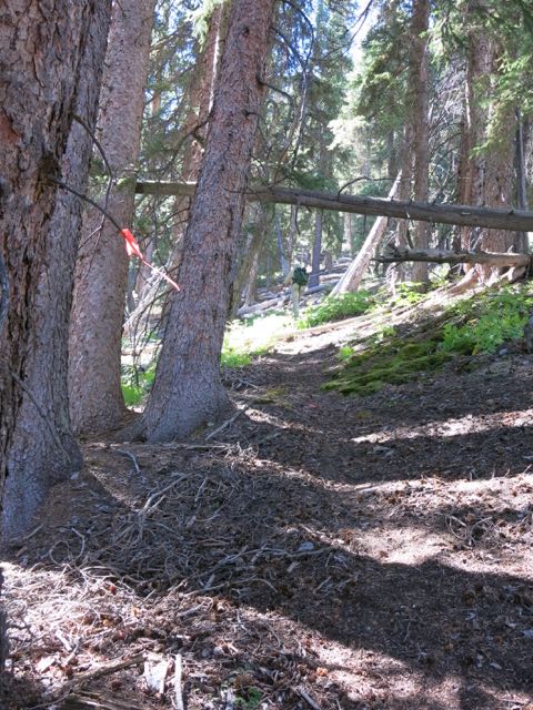
Once above the mining claims we began following a game trail. But the trail was later marked in places with orange surveyors tape. Elk don’t usually do that. My suspicious mind immediately imagined that someone was marking the way to their secret hunting or fishing hotspots.
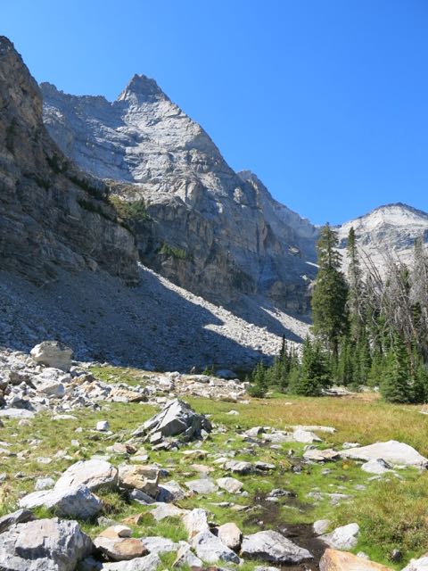
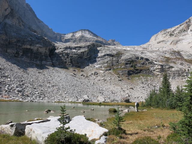
Or was it the route for mountain climbers? 1500′ above the valley floor we broke out into the basin below this peak, Sky Pilot.
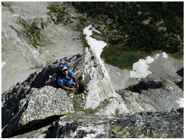
Later internet sleuthing found a blog post about climbing routes on Sky Pilot. Here is a climber’s view from Sky Pilot down to the lake we were headed for. (No, Janene did not take this photo!) More power to them, they can make their crazy climbs and leave the fish for me. For more pics and info on climbing peaks in this area check out the following link.
http://www.idahoaclimbingguide.com/pat-mcgranes-wildhorse-classics-guide/
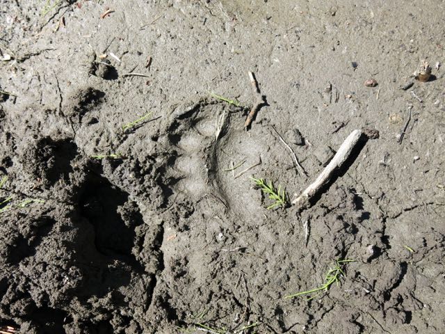
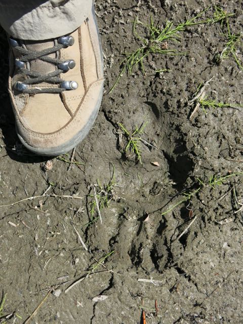
But around the lake there were plenty of game trails, elk beds, and nice fresh footprints left in the soft mud. Like this black bear front paw.
Black bear rear paw.
I had picked this lake because according to the Idaho Fish and Game records it is one they stock with Golden Trout. But it was immediately clear that this lake at 9,000′ elevation is way too shallow to support fish, as it would freeze solid every winter. I later found out that the IFG website has the lakes labeled incorrectly in this basin. The one with fish is another 1000′ higher up the mountain. Oh well, we’ll just have to come back and try again next year.

Well your story leaves out how the mine shut down, maybe you should consult some of the folks of that era, a flood shut the mine down, not the government, nice try though!!
Thanks for your reply, John. I spent a fair amount of time trying to research that mine as it was. Can you give me any leads as to where I might find out more information? I got a lot of my information from a 1999 report by the Idaho Geological Survey titled “History of the Wildhorse Mine,Custer County, Idaho”. See it at https://www.idahogeology.org/pub/Staff_Reports/1999/S-99-6.pdf
It mentions nothing about a flood.
That is one neat place—Gary
I want to go there. It looks beautiful!
>
Your Honda Odyssey van won’t get you quite as close to the trailhead as Moby did. But we’ll wait at the trailhead while you hike in on the rough road to catch up with us.