September is the time to backpack in the high country. The weather is lovely, crowds are thin, and the mosquitoes are gone. With its beaver ponds and still water, Broad Canyon is a great breeding ground for the annoying bastards. The mosquitoes that is, not the crowds.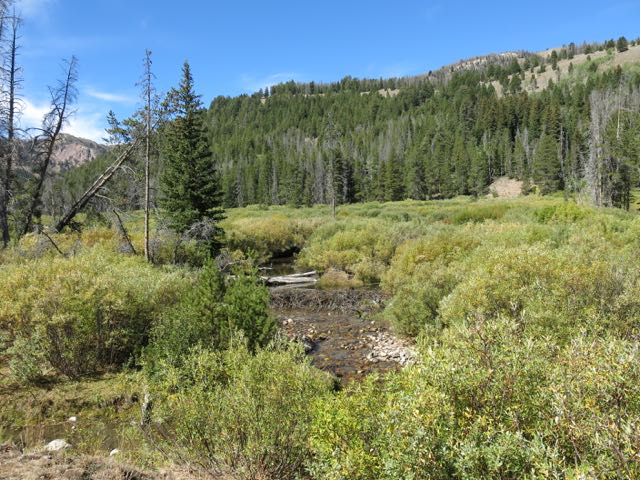
Crossing streams while wearing a backpack is not one of Janene’s strengths. But on well maintained trails like this she gets across without too much stress.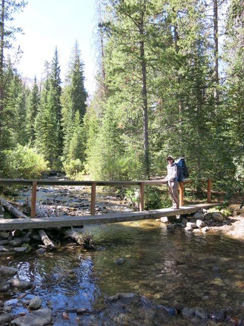
The US Forest Service budget for recreation has been in a long steady decline. Trail maintenance has all but stopped, campgrounds have closed, staffing has eroded. There are many reasons for the decline, but over the last decade, the biggest reason is that an ever-increasing percentage of the entire USFS budget has gone to fighting fires. Congress appropriates money to help with hurricanes, floods, and other natural disasters. But not wildland fires.

Climate change has led to fire seasons that are now on average 78 days longer than in 1970. The U.S. burns twice as many acres as three decades ago and Forest Service scientists believe the acreage burned may double again by mid-century. Yet our Tweeter-in-Chief Trump doesn’t buy into climate change.

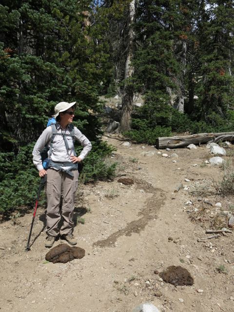
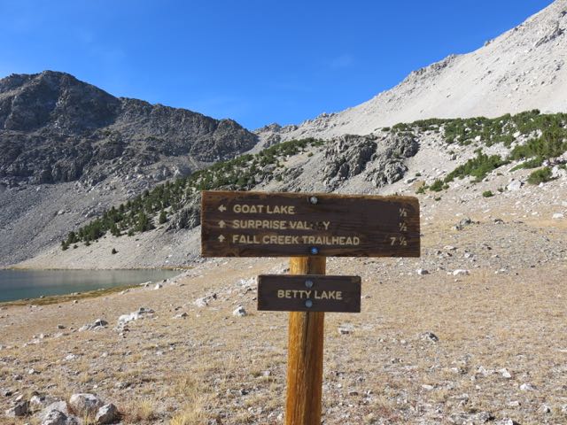
The Broad Canyon trail loop is well maintained. Why would that be? A cynic might think that was because it is only a 40 mile drive from Sun Valley, and the Chamber of Commerce there wants the rich and powerful to have an easy time out in the woods. But whatever the reason, the trail is always well maintained and well signed. No need for backcountry navigation skills on this route.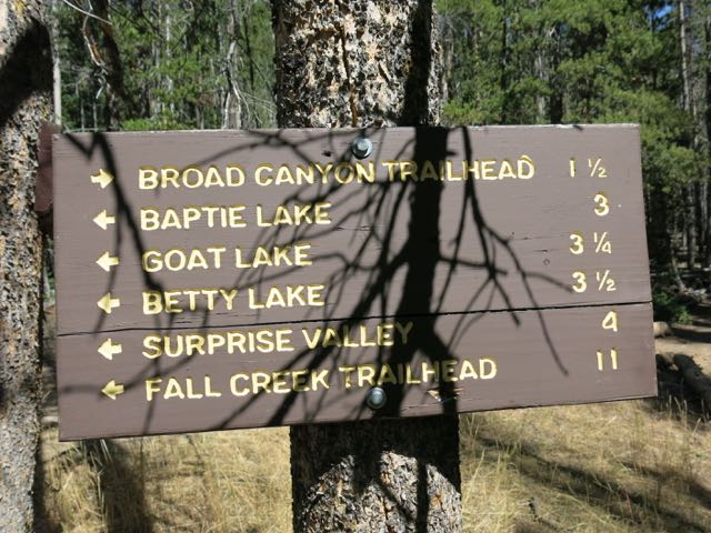
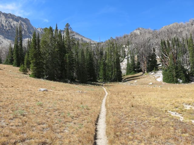
Pyramid shaped Standhope Peak appears ahead once the forest thins out. At 11,878 feet above sea level it is the fourth highest peak in these Pioneer Mountains. Ice age glaciers carved out the broad U-shaped valleys below.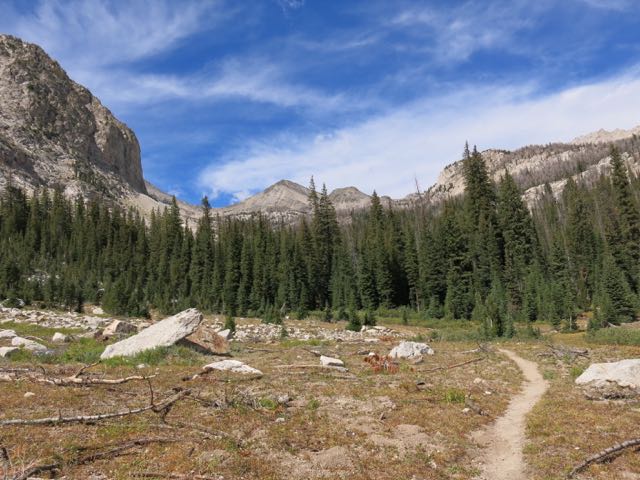
The cows have been rounded up by September. This high sub-alpine area doesn’t seem like cattle country, but they do leave their calling cards behind.
It breaks my heart to see the skeletal remains of the dying forest. Our warming climate has doomed Idaho’s high elevation giants such as the whitebark and limber pine. Once the dominant tree above 8,000′, 99% of them in the Pioneers are now dead. They are victims of the tiny (5mm) Mountain Pine Beetle. Ever increasing hot, dry summers and mild winters have led to this epidemic. Populations of squirrels, jays, bears, and many other forest critters that depended on the pine seeds have declined as well.
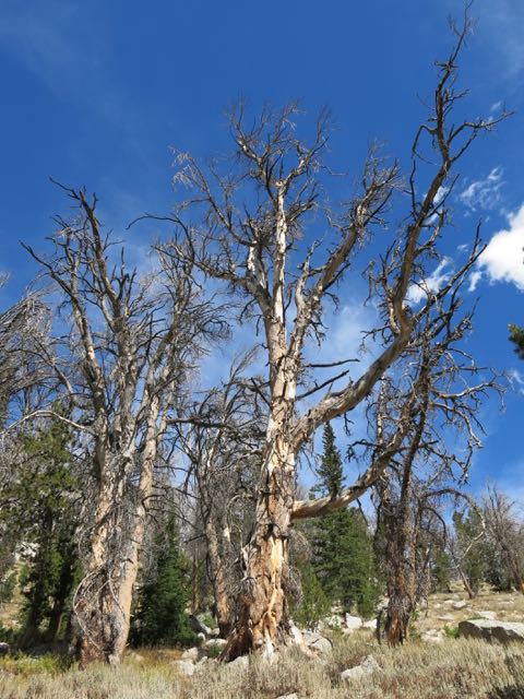
This five-mile hike into the first lake climbs 2,000′, but it saves most of the elevation gain for the last mile. The pointy green trees are firs, unaffected by pine beetles. All the gray trees are the dead pines.
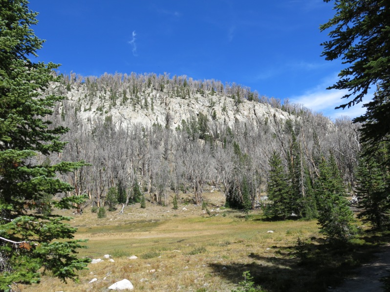
Once green forested ridges are now grey with death.
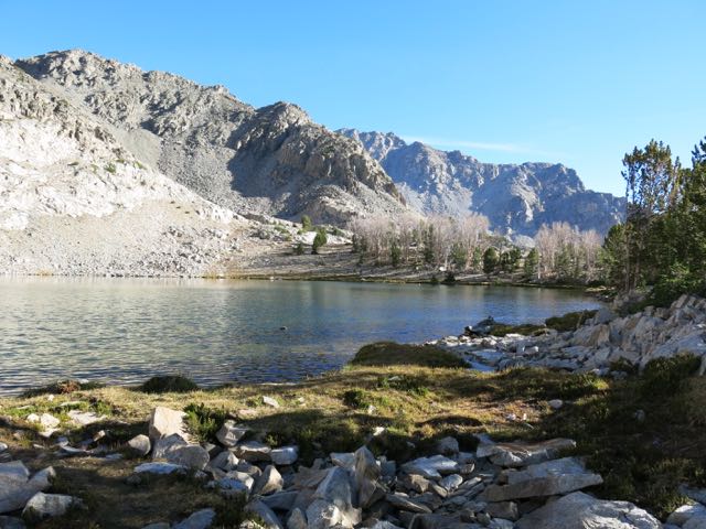
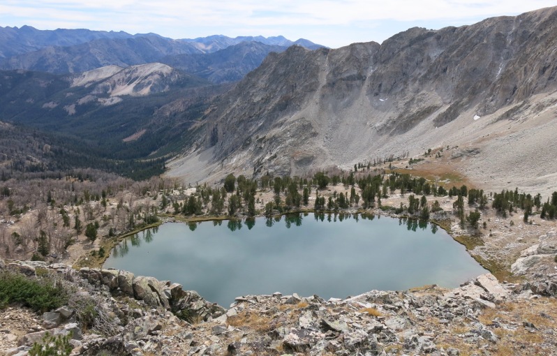
At a bit over 10,000′, Baptie Lake is our destination the first day.
And here is my reason for coming to Baptie: Golden Trout. Native only to the Kern River in southern California’s High Sierras, they do well in the Idaho high lakes.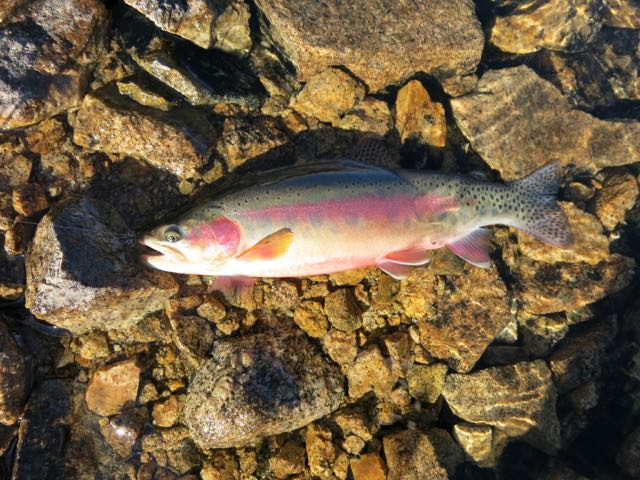
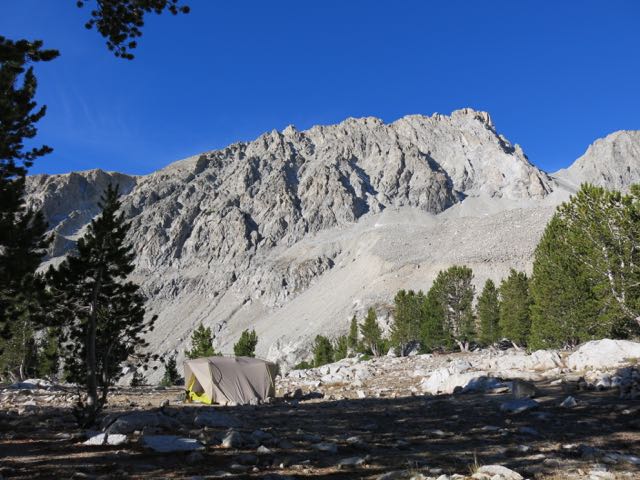
Our camp under one of a zillion of Idaho’s unnamed 11,000’+ peaks. Young pines with plenty of water like these near the lake can produce enough pitch to fight off the pine beetles. Bigger older pines on dry slopes cannot.
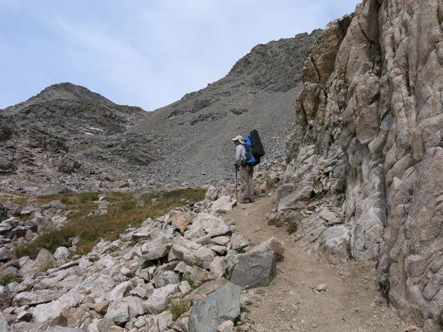
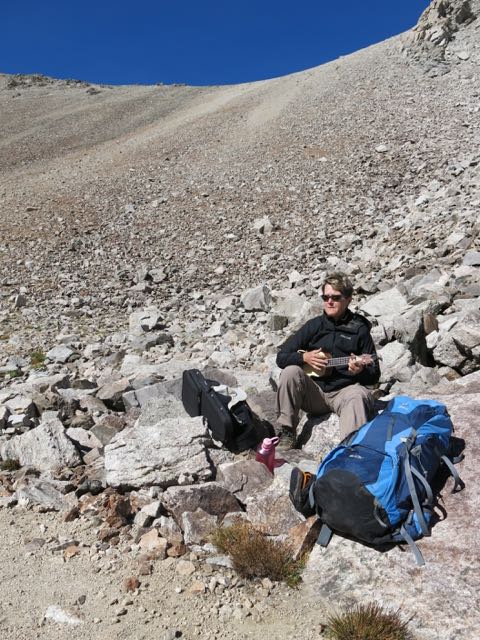
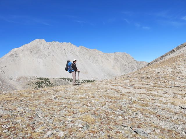
After a night of freezing temperatures Janene heads up the hill to our next lake. Like most backpackers, especially old ones, we strive to keep our packs as light as possible. But Janene could not leave her new obsession behind in Moby, so she strapped her ukulele case to the pack.
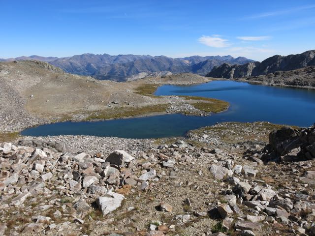
If all the lower 48 states were ironed out flat, Idaho would be the largest. So says Statemaster.com (see it here) . Texas is big, but oh so flat. Colorado has its famed “fourteeners”, peaks exceeding 14,000′, but they tend to be isolated points. Montana claims to have the most acres of land above 12,000′. But Idaho is chock full of high mountainous country. This view south out over Baptie Lake shows just a small portion of the least spectacular part of the Pioneer Mountains. Broad Canyon can be seen curving off to the left below Baptie.
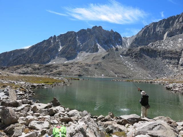
Next stop: Goat Lake, said to be the highest lake in Idaho at 10,438′. We spotted a wolverine here a couple of years ago. Short on time, my plan was to fish only my favorite corner of the lake. But rising fish forced me to start fishing before I got there.
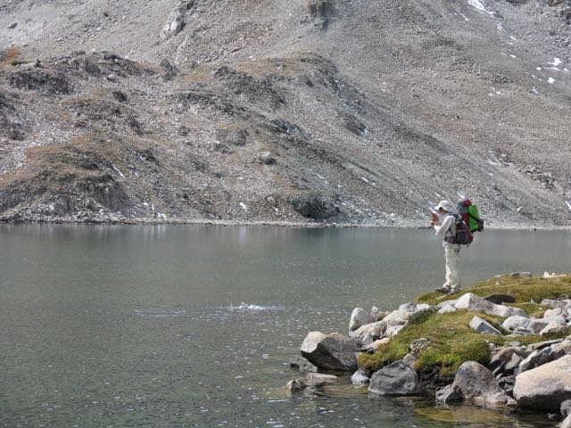
Still trying to make it to my favorite area, I started to circle a shallow arm of the lake. But the warmer shallow water was perfect for setting off a fly hatch, and pod of big fish were gulping flies throughout the bay. Clearly I was not destined to reach my favorite area. For fly fishers this shot below is pure trout porn.
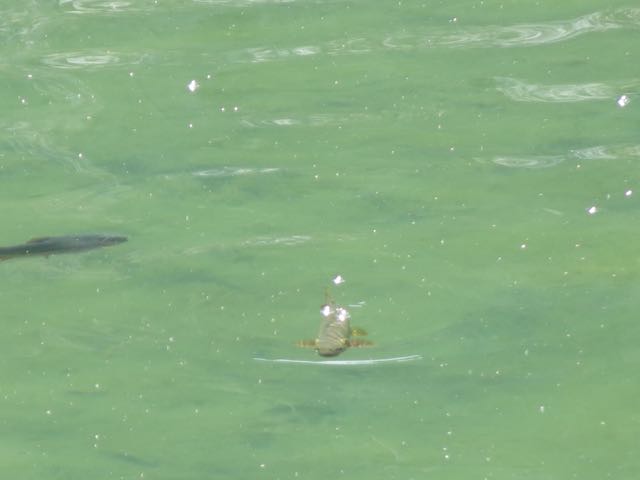
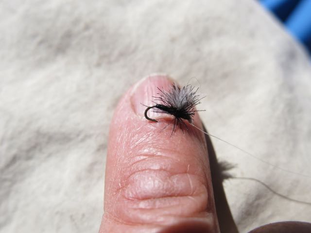
The tiny midges that the trout were eating were way smaller than any artificial fly. Probably five of them could have fit on my pinkie fingernail. But I gave it a try with this fly that was at least the right color.
Its called fishing, not catching. Sometimes you get skunked. But for 90 minutes in this lovely spot it was nothing but catching.
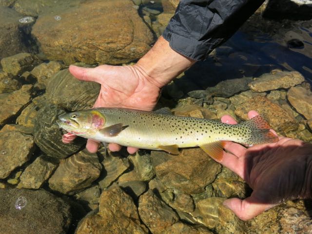
Native to the Yellowstone River, these Yellowstone Cutthroat Trout do well in mountain lakes. Golden Trout are spooky, often finicky, and notoriously impossible to catch at times. Cutts on the other hand are known as the dumb blondes of the trout world. And they were true to form here in Goat Lake.
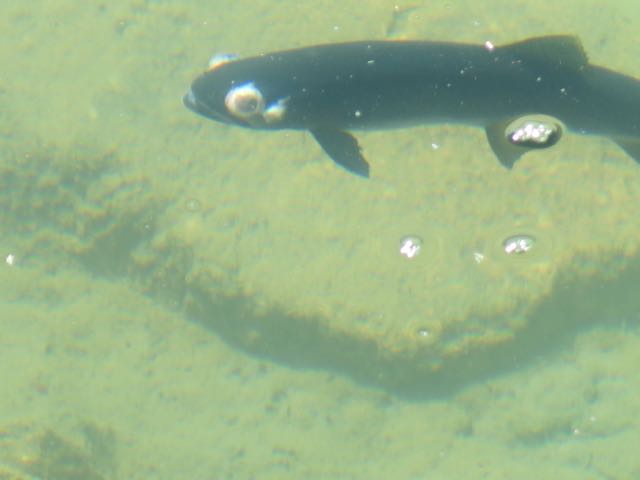
A rare Bug-Eyed Coal Trout? No. This poor guy had some health issues.
Janene is usually so thrilled to watch me fish that she has to get out a book and read just to calm down. But now she relaxes to the soothing sounds of her uke. Behind her is the pass over to the next lake.
Goat Lake.
The ukulele sherpa on top of the pass. An unnamed 12,800′ peak behind her.
In these low boulders there is a perfect little tent site. Perfect for some. But not for Janene, a.k.a. “The Safety Monitor”. She always insists on camping far from the looming boulder above.
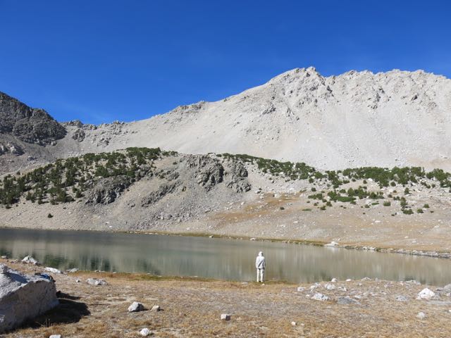
Betty Lake, 10,379′. Over the 11,000’+ pass to my left is a spectacular trail leading to Fall Creek, more lakes, and surprising valleys.
So many beautiful places to go in the Pioneers.
This is a popular hike not just for the beauty and the fishing, but also because it can be made into a loop. Backpackers love loop hikes. Going back this way back to Moby we passed by several more lakes before returning out the opposite side of Broad Canyon.

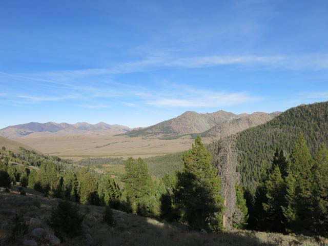
Forested Broad Canyon empties into sage filled Copper Basin below. There Moby waits to take us to the next lake basin to the north in the Pioneers.
Want to see more? Read about a previous trip to Broad Canyon here: Moby Goes to Larry’s Secret Hot Spot.

Thanks for the great pictures. 😀😁