Salmon 385. Part 1 – In the first leg of our 385 mile trip in the Salmon and Snake River basins, Janene and I rafted 100 miles down the Middle Fork of the Salmon River in seven days. Read about that at Moby Goes Salmon 385 (Part 1 of 3)
Part 2 – Our second leg was a seventy mile backpack in the Frank Church River of No Return Wilderness (aka “The Frank”). Dear Readers, prepare yourself for seventy pictures in this blog to go with the seventy miles. Daughter Katie clued me into a term young folks use online these days, tl;dr. It means “too long; didn’t read”. I figure some readers of this blog might feel the same way, but if so, tb;idc. “too bad, I don’t care”. If you just scroll through the photos my feelings won’t be hurt.
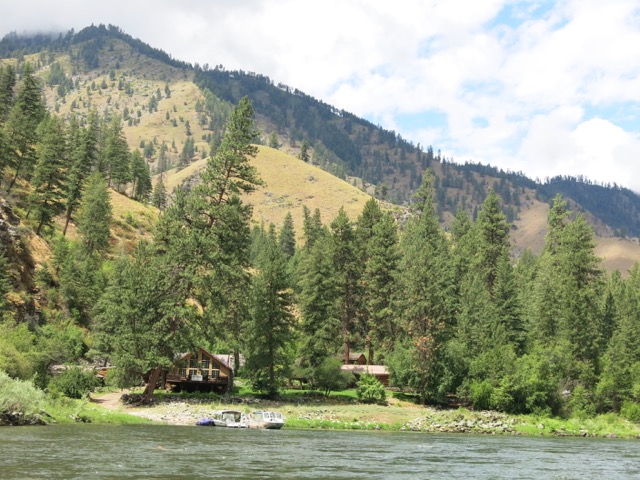
At the end of the first leg on the Middle Fork, Day 7 was in cold pouring rain all the way to the takeout ramp just past the confluence with the Main Salmon River. There we gave our garbage to our Boise bound pals, loaded up our backpacks and gear that we would need for the next leg, and floated on down the Main Salmon to our next camp spot: the Salmon River Lodge Resort. It was a sight for sore eyes.

How civilized. Our little blue raft, the Hail Mary, could dock here for the next week while we were in the mountains above. The lodge is accessible only by boat. Read how the Hail Mary got her name at Moby Goes to Whitewater Rafting School.
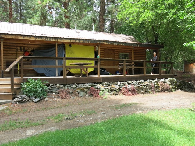
Salmon River Lodge Resort is a lovely place. A real bed, electric heat, and a hot shower felt mighty nice after a week on the river. But it didn’t take us long to trash up the place as we hung out our wet gear to dry. Check it out at http://salmonriverlodgeresort.com/lodging/.
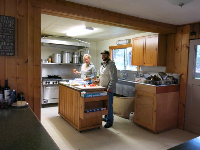
On top of the plush accommodations, owners/hosts Natasha and Brooks cooked up some tasty food as well. Brooks is a top ranked hunting guide. He quizzed me to make sure I knew what the hell we were getting into, and wanted to be sure we weren’t going to get lost. He said some of the lakes we were going to hadn’t had a human into them in years. The Frank is the largest contiguous wilderness in the Lower 48. At 3,700 square miles it is nearly as big as Rhode Island and Delaware put together.
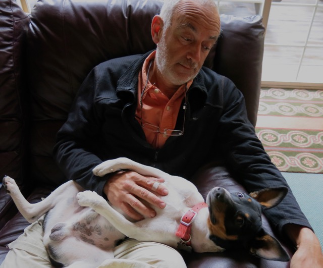
Jack, the Lodge Terrier in Residence, is happy to listen to your stories. He claims to be a certified therapy dog, and aspires to accompany his owners into swanky big city restaurants someday. But for now he deals with the disappointment of being banned from the lodge dining room.
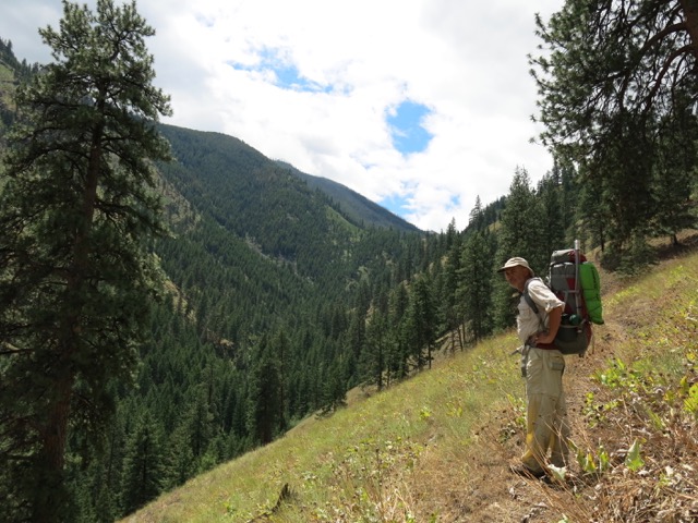
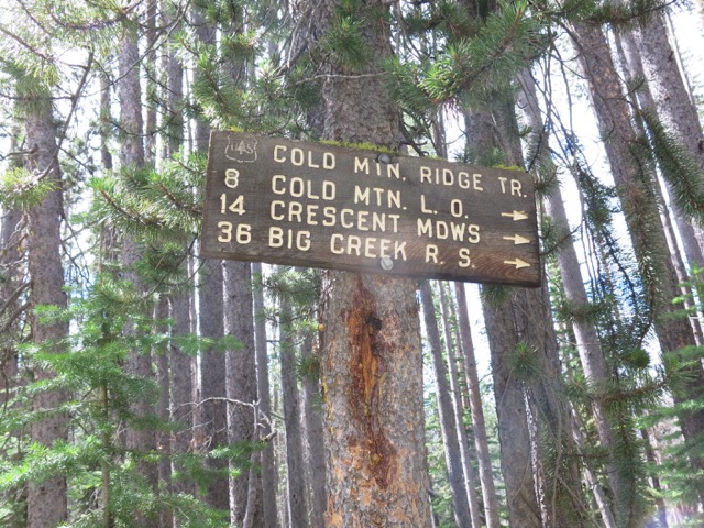
But twelve hours of luxury was enough for us, so the next day up Butts Creek trail we went. Generally, I don’t like to reveal my “secret” uncrowded places. I think people who splash their favorite places all over the internet are crazy. But this area is so remote and underutilized that I think it could use a little publicity, a few more visitor, and a few more friends. The forces of greed in America are making a concerted effort to take our public lands away from us. The more we use our lands, the more we will fight for them.
Janene and I have a game we like to play on our trips. It’s the “how many people will we see today” game. Well, Dear Reader, you too can get in on this game. In this week long, 70 mile hike, guess the total number of people Janene and I encountered. Submit your guess in the comment section at the end. If you guess correctly you’ll win a fabulous prize. The answer will be revealed at the end of this post.
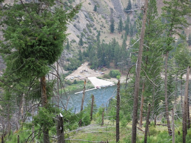
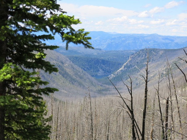
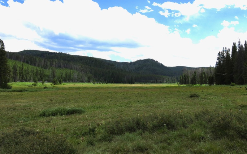
An hour later we could look down on the Corn Creek boat launch, where in a week we would join another group of rafting pals to begin our float down the Main Salmon river.
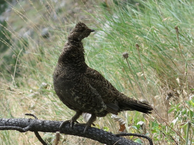
The forest grouse, aka “Fool Hen”, are one reason the term “bird-brained” is not a compliment. While you can’t actually catch them by hand they often just sit next to the trail in easy range of a stick or rock.
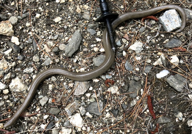
Also on the trail was this rubber boa.

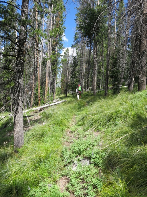
Hours and lots of sweat later we again look down on Corn Creek and the lodge in the bend in the river. The hike to the top is 8.5 miles, but it gains over 5,000′ elevation. There were endless switchbacks in our 5 hour plod to the top.
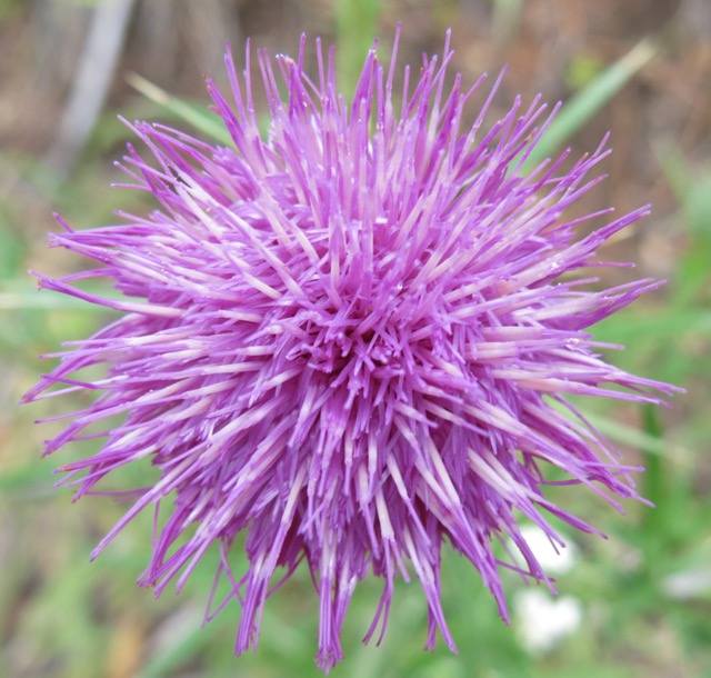
Albeit mid-July, there was still snow on the ground and a host of different flowers like this thistle were blooming out in what was their spring time.
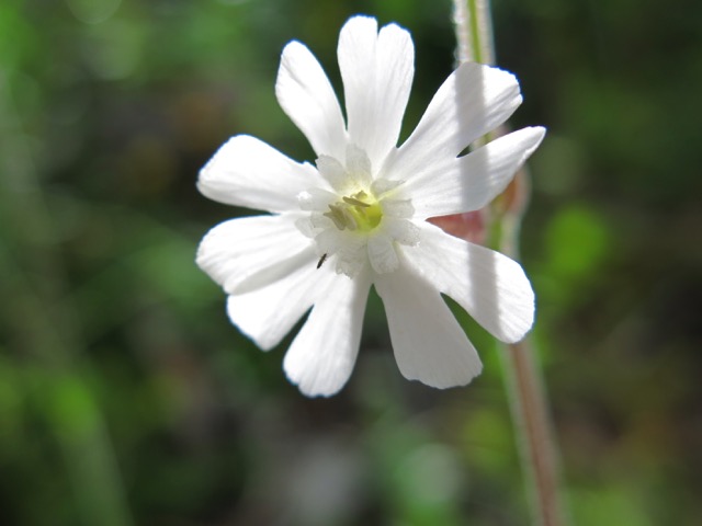
White as snow.
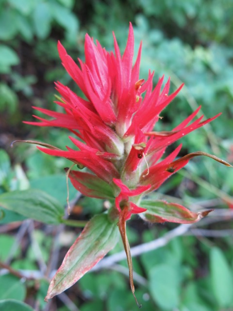
Indian paintbrush.
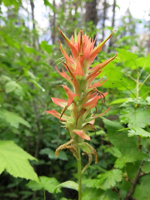
I love Indian paintbrush because it grows in the wild, and I see it often in the remote places I love to go. There are over 200 species of this plant, and it is native in the West from Alaska to the Andes, in the mountains, the desert, and next to the ocean. It is even spread all across northern Asia.
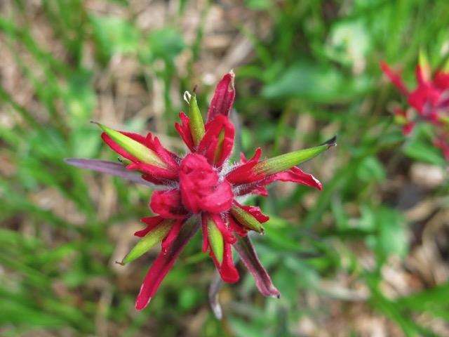
Indian paintbrush bud.
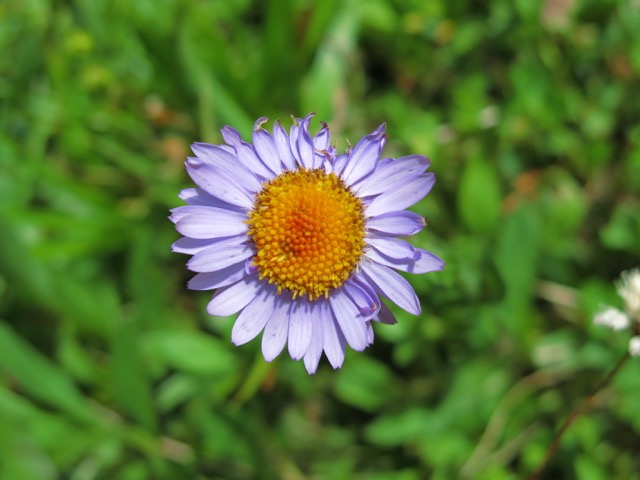
I always thought those little purple daisies in cheap bouquets at the grocery stores were fake dyed colors. Maybe not.
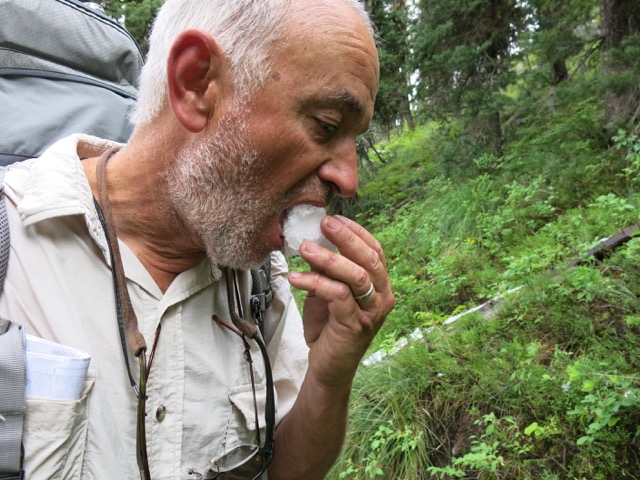
Who knew snow cones would be available here to quench our thirst?
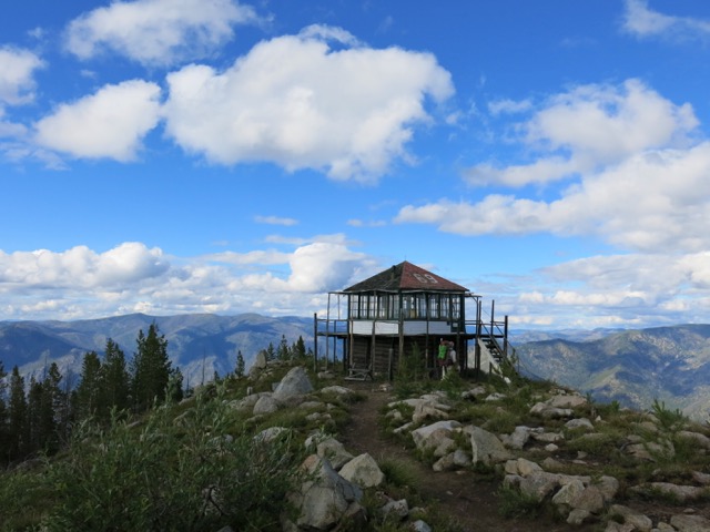
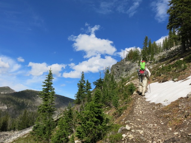
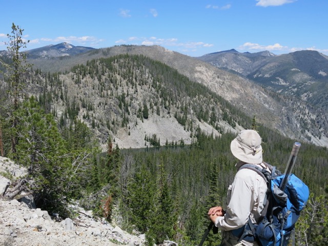
At last, our first day’s destination: Butts Creek Point, with views from Montana to Oregon. An old US Forest Service lookout here has been lovingly maintained by a former summer fire spotter who served here while in college in the 60’s. Now a retired physician in Boise, he has kept the lookout from falling apart, and got it listed on the national register of historic buildings. For his efforts he was rewarded with a heavy bronze plaque that he then had to lug up the mountain to affix to the structure.
Sadly, the USFS silent policy over the years was to just let these old lookouts fall into disrepair and ruin. But through the efforts of one man, this lookout survives. It pretty much looks like it would have 50 years ago.
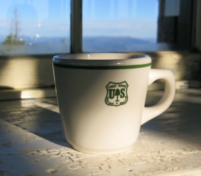
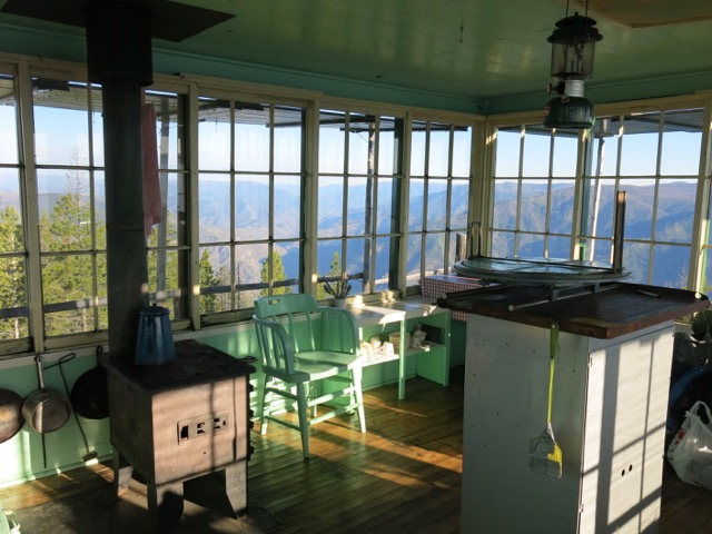
It is stocked with everything one needs for a comfortable stay. A dark secret of Janene’s is that she is a known international thief of cute glassware. I kept an eye on her to be sure this classic coffee mug did not go into her backpack.
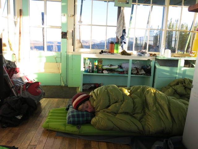
Despite the amazing views, some of the old tired grandmas in the group were fast asleep early and missed the sunset.
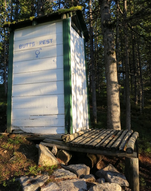
By leaving the door open, a fine view over the canyon was available the next morning from the outhouse. The painters here at Butts Creek Point obviously had a sense of humor.
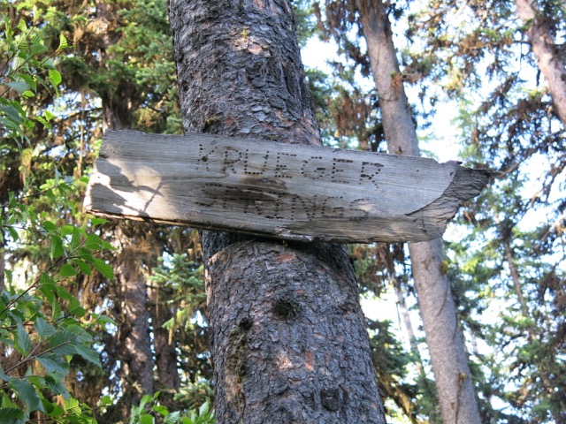
An unmarked trail led to this sign at the nearest water source.
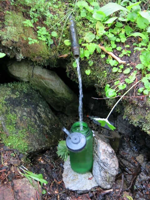
No filtering or purification is necessary at Krueger Springs.
On the side trail to the spring we would never have noticed this nest under the rock in the shadow (if you look carefully, you can see the eggs) had the tiny mother bird (a wren?) not flown out right in front of us.
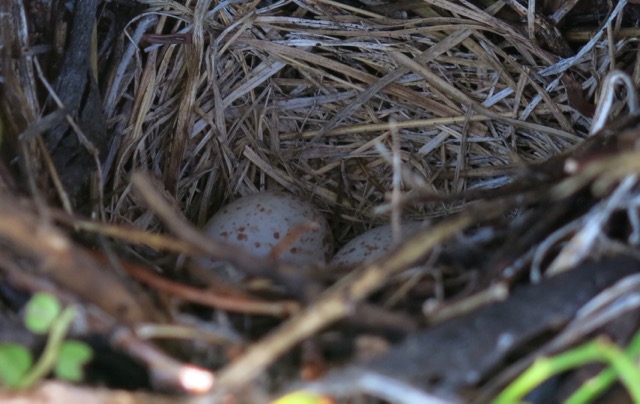
Their rock shelter kept the nest dry.
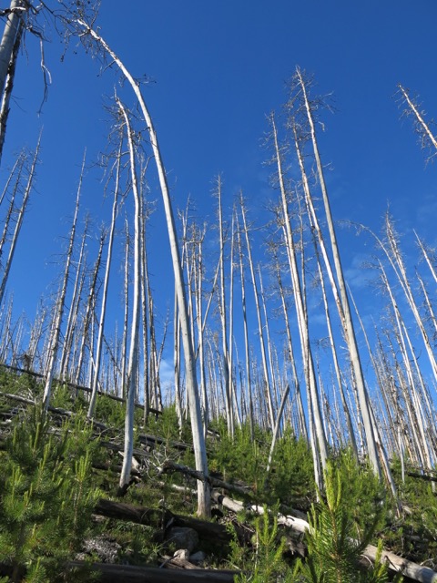
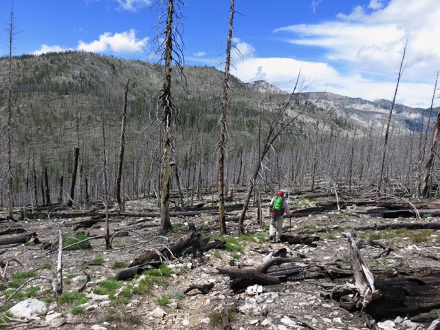
In an old burn, new lodgepole pines come back slowly. Suppressed during the regime of Smokey the Bear, natural fires are now left to burn in wilderness areas. This is a controversial, complex issue, a volatile stew of old management ideas run smack into modern ecological science, all brought to boil by divisive politics. On top of this, as our climate warms, the scope and frequency of such fires has increased.
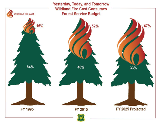
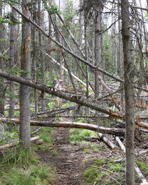
Firefighting now consumes more than half of the USFS budget. This leaves little money for the many things Smokey the Bear used to do.
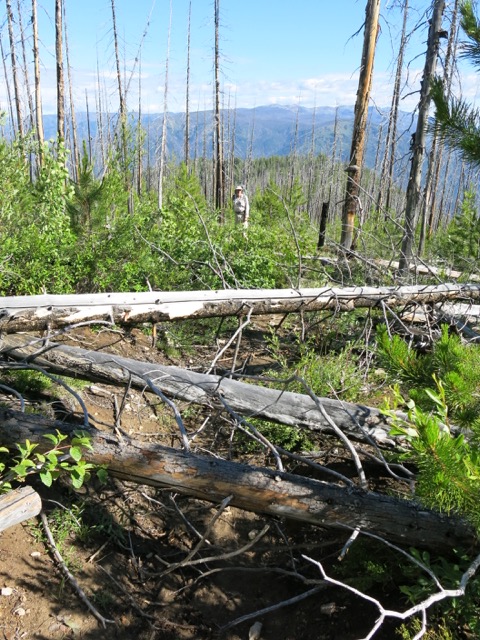
Like spending money on trail maintenance. The trail looked like this time and again, sometimes much worse. Normally while backpacking two to three miles per hour is a good pace. With all the downed trees, we struggled to average one mile per hour.
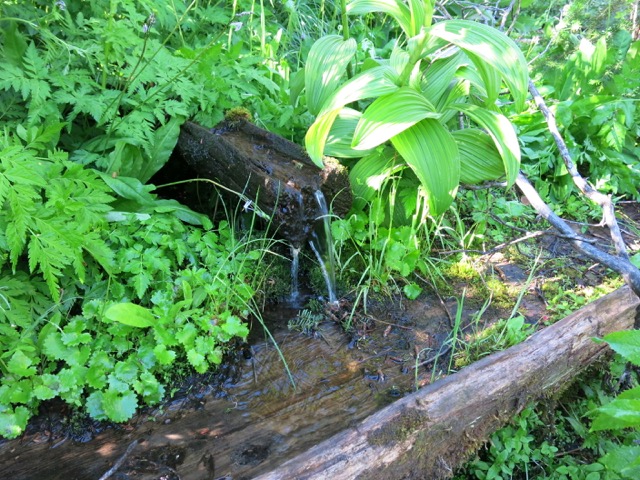
At Stub Creek spring the water trickles down a carved log before emptying into an old wooden watering trough.
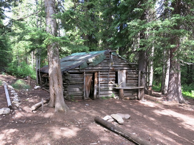
This old outfitter cabin is a bit of a fixer-upper.
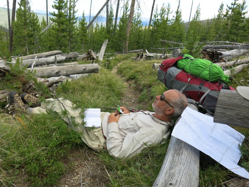
Day 2 we planned on covering 12 miles to reach Stoddard Lake, which included 2400′ uphill gain and 1800″ of downhill loss. But the downfalls really slowed us down.
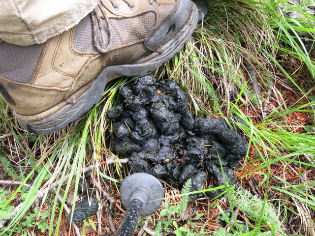
Bears, on the other hand, apparently travel here all the time and left their calling cards along the trail. As did the cougars, wolves, and coyotes.
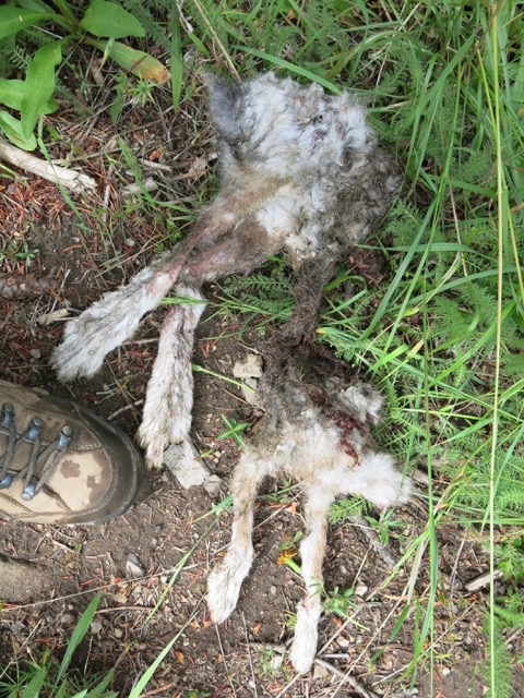
Someone ate all the tasty bits out of this snowshoe hare and left the remains on the trail.
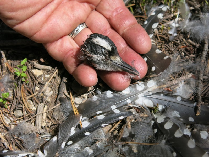
Somebody picked this woodpecker pretty clean.
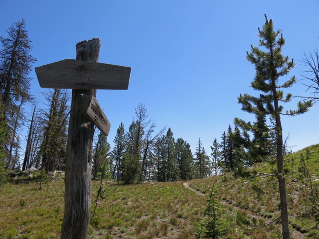
Cottonwood Butte, at 9349′, is the highest peak in the area. This part of The Frank lacks majestic snowy peaks, which is part of the reason it attracts few visitors outside of hunting seasons.
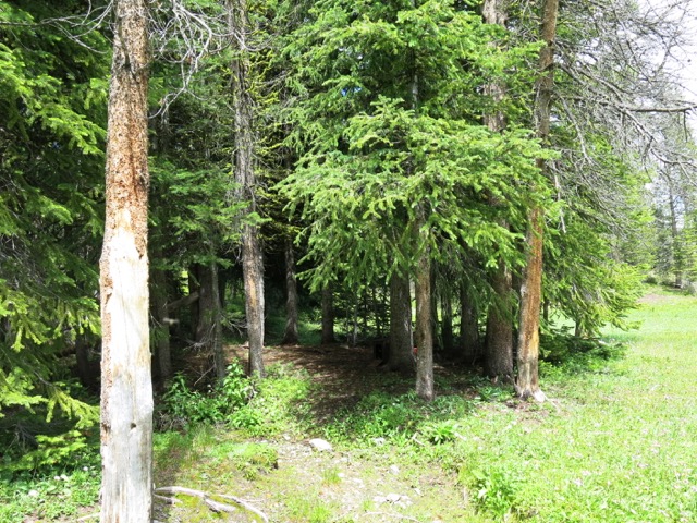
The main trail here was faint, and fainter still was a side trail leading off to this little cluster of trees. It led to this circle of trees with a perfect round camp site in the middle. Old lodgepoles were stacked nearby, no doubt to frame a shelter. A spring fed creek, an easy source of clean water, flowed right behind the little grove of trees.
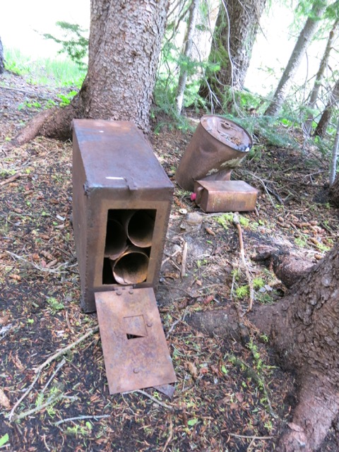
In the grove was an old woodstove filled with chimney pipe. No doubt this was once someone’s annual hunting camp. Many memories were undoubtedly made here. But after so many years do the memories even remain, or are the minds that once held them dead and buried?
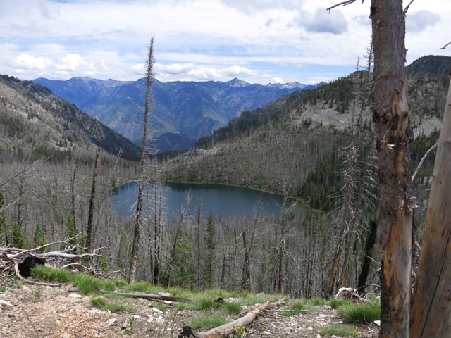
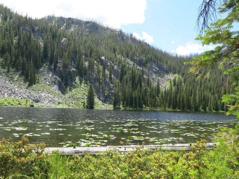
Stoddard Lake. There is no trail down. Find your own route.
Our route to Stoddard Lake the night before involved a race with a huge black thundercloud. We almost had the tent set up when the hail was unleashed. I dove in the tent, leaving Janene to finish pounding in the tent stakes. What a woman! No use both of us getting soaked.

There was a lot of drying out to be done the next morning.

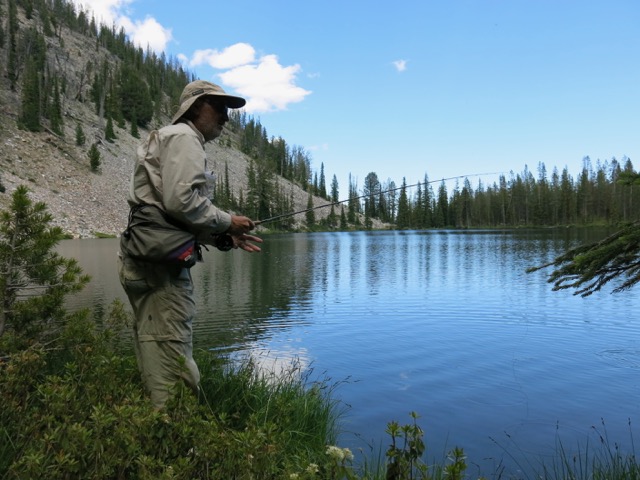
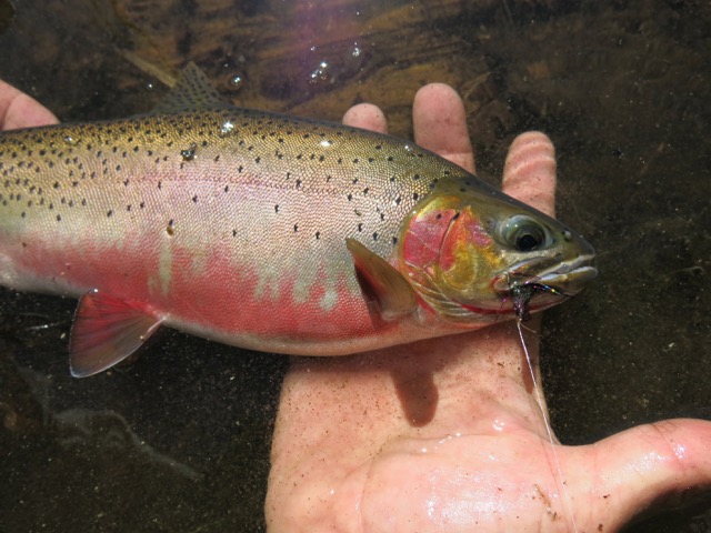
Lurking in the dark waters of Stoddard Lake were plenty of large cutthroat trout. But sadly, Day 3’s hike of 8 miles (2400′ up, 1600′ down) pulled me away from the great fishing.
Luckily the meadows are fire-proof. (High mountain July spring-green grass, this photo is not color enhanced!)
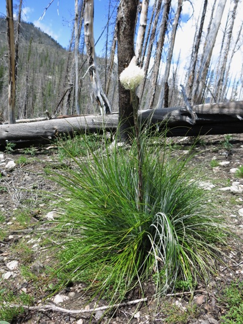
Bear Grass survive most fires.
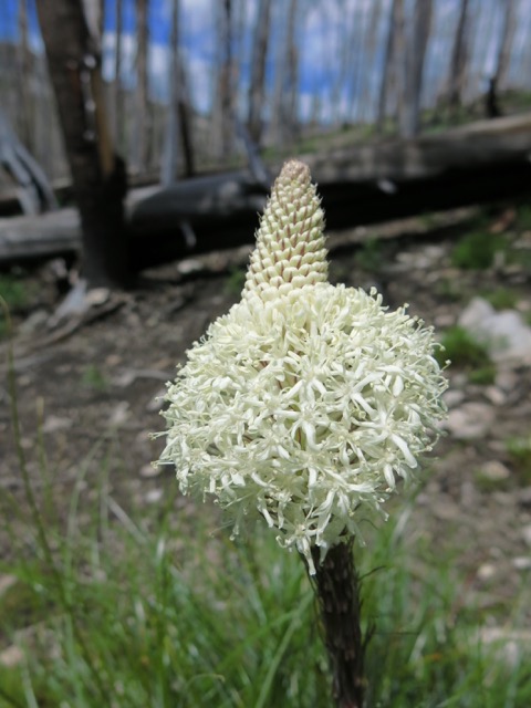
Bear grass has long lasting blooms.
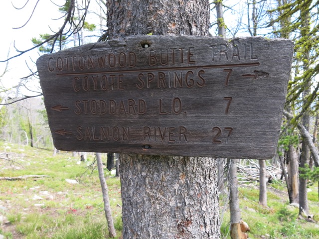
Wooden signs don’t do well in fires. This was one of the few we had seen up to this point.
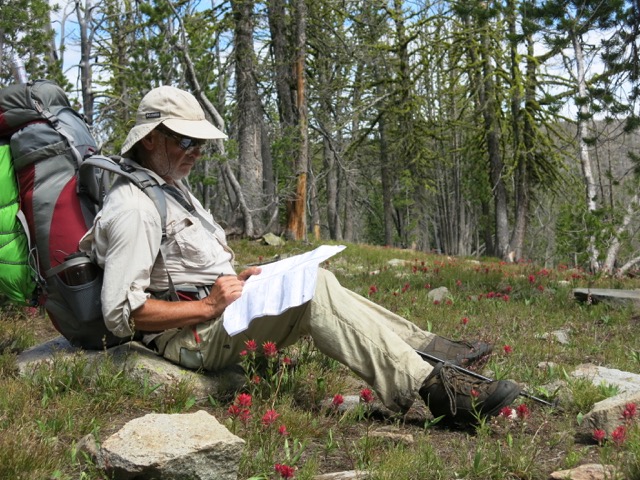
Few signs + no trail maintenance + no foot traffic = tough navigation. We never got lost, but there were plenty of times we didn’t know where we were.
The burns were so bad in some areas that the trail was nearly impossible to follow. Such hot burns sterilize the soil, as seen here where after a decade only a bit of grass grows.
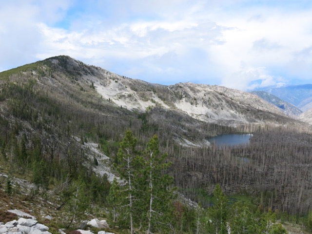
For me, lakes are the gems hidden in the wilderness. This area was badly burnt. Gray = burnt.
Trail to the clouds.
We barely made it to Papoose Lake before sundown. We were so tired we just ate dinner and went to bed.
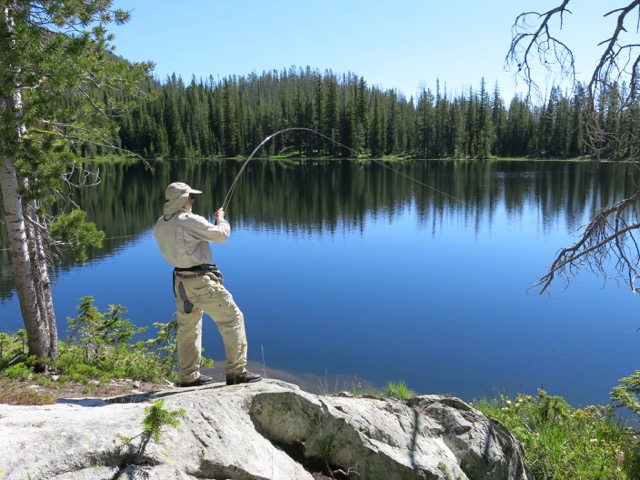
But the next morning the fish were there waiting for me. One after another after another.
Plump and colorful.
Likely I was the first, and perhaps only, person to fish Papoose lake this year.
But again, miles to go before we sleep. Day 4 promised only 7.5 miles in distance, but involved a daunting 3,100′ elevation gain mixed in with a 2,500′ loss.
Next stop: Trapper Lake. Once again, no official trail leads to our lake. But we lucked upon a faint game trail that led us down through the cliffs in the right general direction.
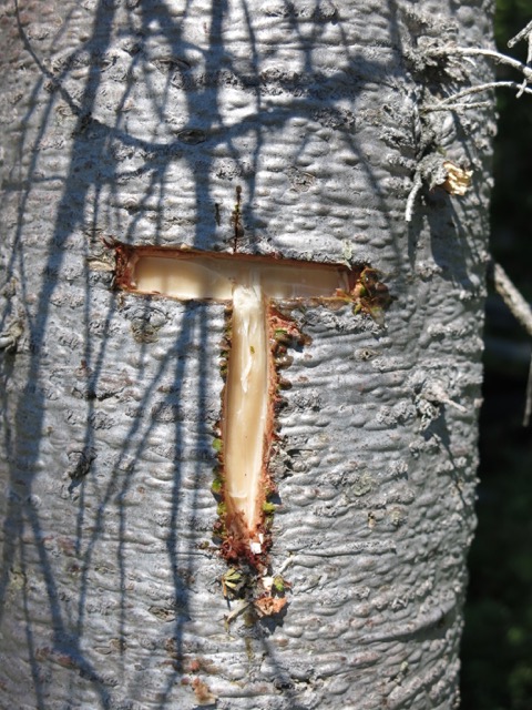
Looking for the lake yourself? Find this “T”, head for the cliffs, and the game trail will be right there.
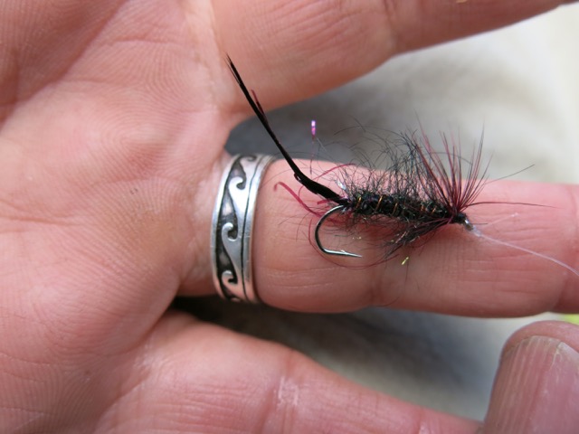
With this one fly. . .
. . . standing in this one spot, not moving more than a couple feet in either direction because I was hemmed in by trees . . .

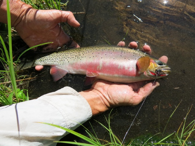
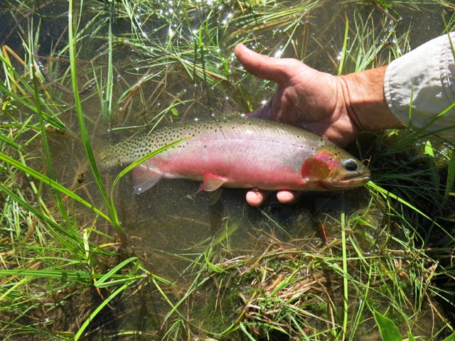
. . . I landed 17 of these beauties in a little over an hour. As we had to hike on to our next camp, Janene thought 10 Cutts would have been a good number to quit at. But I had never caught so many fish standing in one spot before, so I just had to keep going. How many might I have caught had I fished my way around the entire lake? Maybe next time I will find out.
More fish porn.
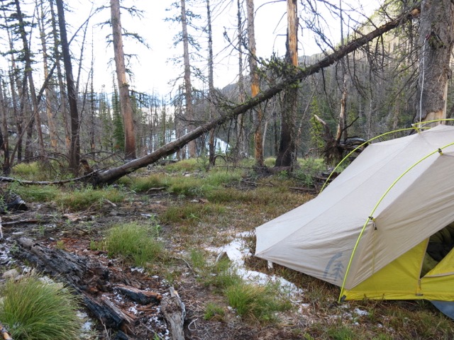
Night 4’s camp.
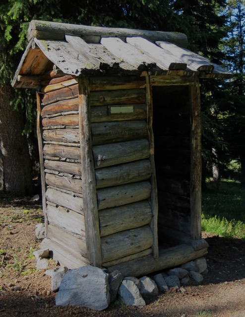
Complete with its own official USFS stamped nameplate, this might be the finest and sturdiest outhouse I have ever seen. Or was it used for something else? Perhaps a bear- proof storage locker? There were no indications of other buildings around.
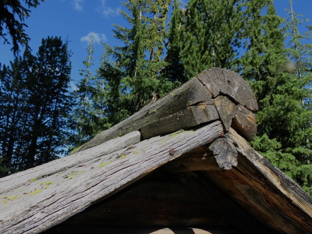
The carefully crafted roof ridge. They don’t make ’em like this any more.

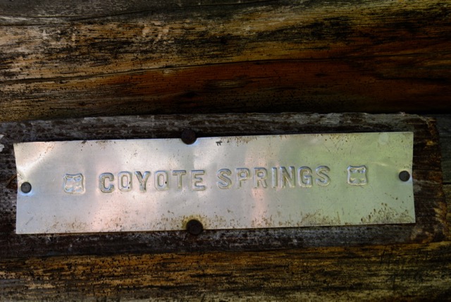
Coyote Springs. Pure cold water. Home to thick clouds of mosquitoes that swarmed us in our nearby camp. (Nope–none of the photos in this blog have been color-enhanced.)
This is a big wilderness. Day 5 would be our longest day: 14 miles, with +1,100’/-3,300′ elevation changes.
With so little traffic the trails here have become overgrown with beargrass and lupine.
Not much chance of having my nap disturbed by rush hour traffic here on Trail #044.
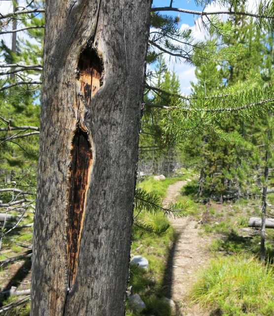
The “i”, a dot with a line underneath, is a blaze mark that was chopped into this tree long ago while it was still alive. It may have been put there by the original trailblazers who marked the route for the trail building crews that came later. The blazes also serve as markers to follow if the trail is invisible under deep snow. But with all the fires these blazed trees are gone in a lot of places, which would make navigating in the snow pretty tough.
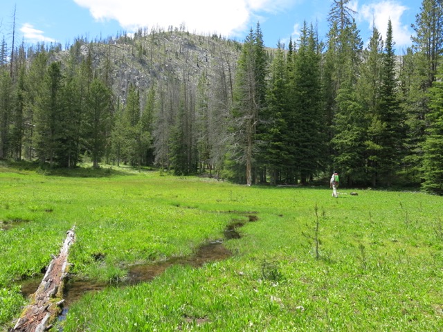
Trail #044 led us from Coyote Springs to Cottonwood Meadows. These wide meadows go on for about 5 miles. This valley is home to a wolf pack, and we saw their scat frequently on the trail. We did not see any wolves, but they surely knew we were here.
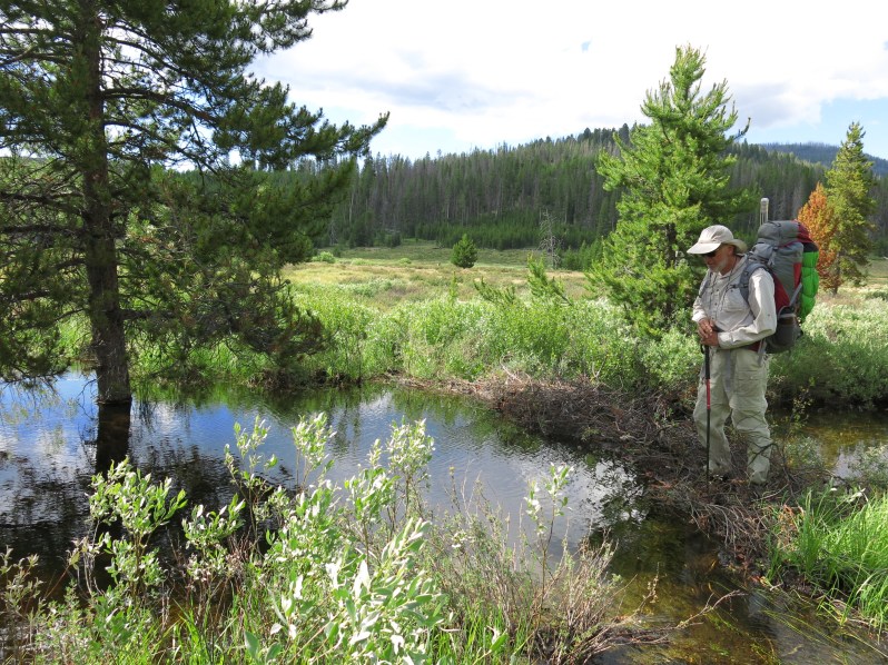
With meandering meadow streams it can be tough to find places to cross without water going over our boot tops. But beaver dams make excellent bridges. Janene aka “The Safety Monitor” doesn’t trust them, so I always cross first to check it out.
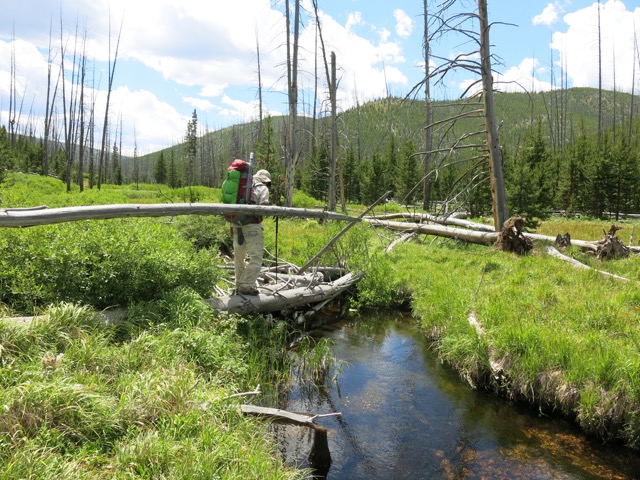
Ditto for fallen log crossings.
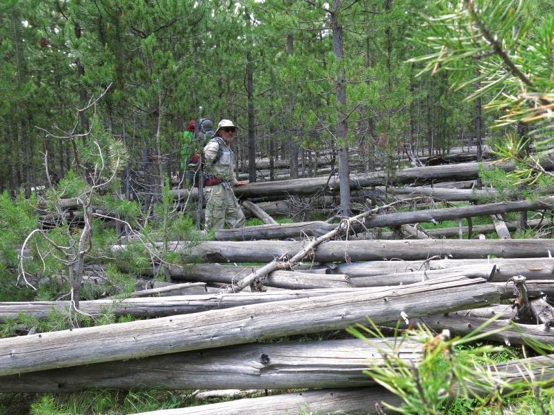
After a blessed five miles of meadow hiking without any fallen trees, this sort of deadfall brought us back to reality. Believe it or not, I am on the trail, right in the middle of nature’s game of pick-up-sticks.
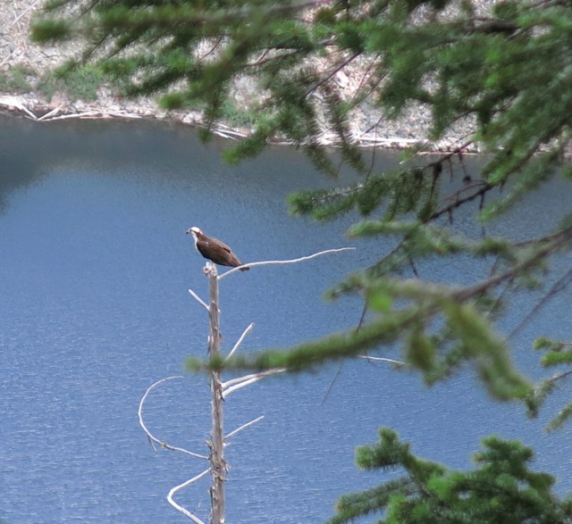
It isn’t often that I get to look down on an osprey.
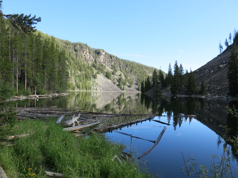
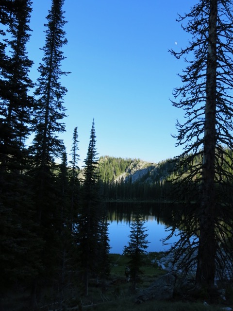
View from our camp at half mile long Black Lake.
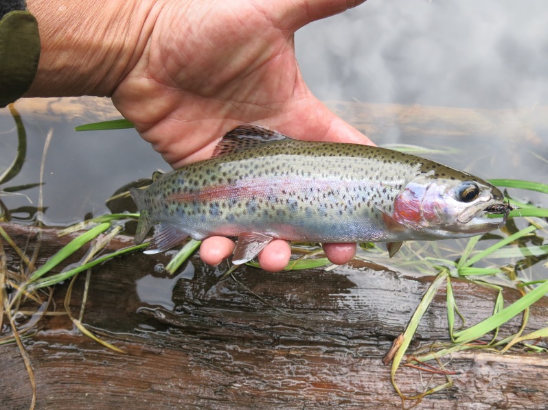
All the other lakes on this hike had cutthroat trout, but Black Lake held rainbows. Astute fly fishermen will notice that this is the very fly that caught 17 fish back at Trapper Lake. (I have a Fly Hall of Fame, and this one should have been entered, but I lost it later to a pine tree and was very sad.)
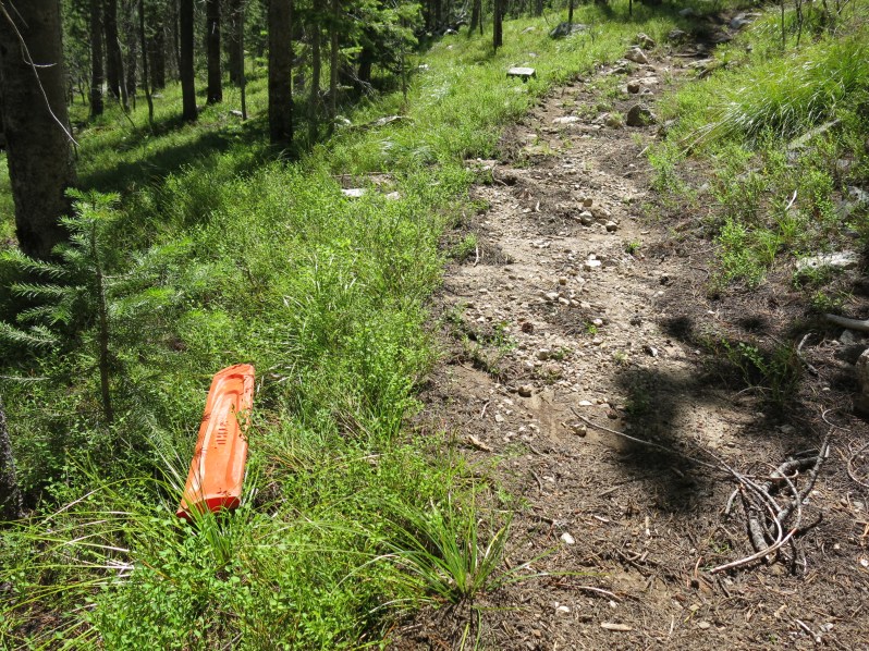
The next morning, the trail leaving Black Lake switchbacked 2,000′ up, but was only one mile as the crow flies. But it was in good shape, with few trees fallen down across it. Keep in mind that no motors of any kind are allowed in wilderness areas, so all trail clearing must be done by hand. Which made this chainsaw blade cover we found lying next to the trail a little suspicious. It wouldn’t hurt my feelings if someone came through with a chainsaw and did some trail work.
Day 6 was only 9 miles, but taxed us with +3,300’/-2,100′ in elevation change. Basin Lake made for a good midway lunch spot.
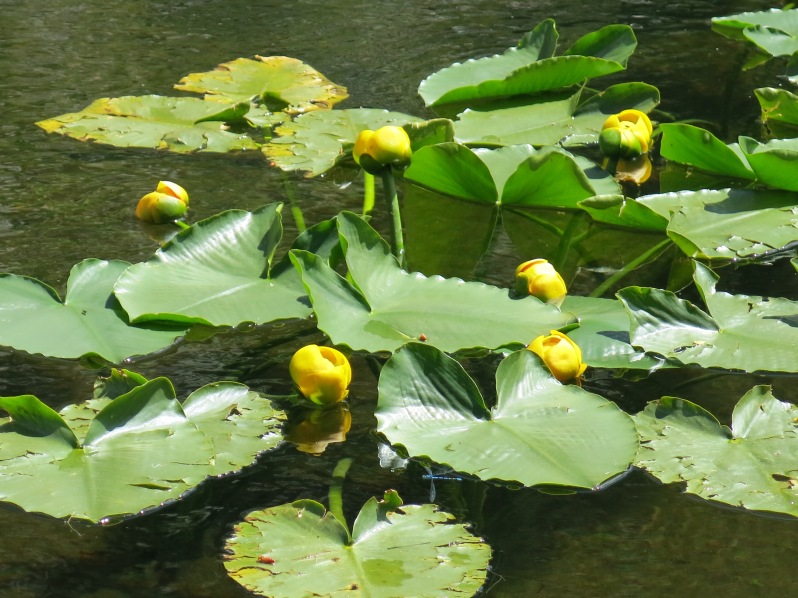
To me, these big lily pads seem out of place. In my mind they belong in swamps down south where gators lurk. But they are common in the mountain lakes of Idaho.
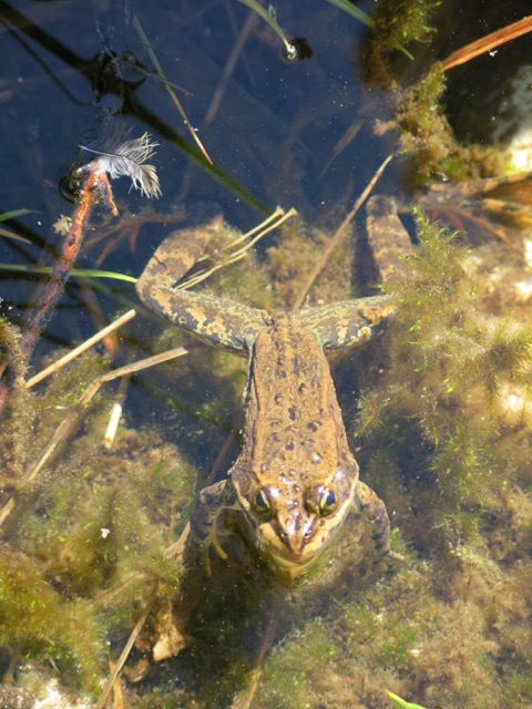
I see a lot of frogs lurking in these high lakes. But never on a lily pad. Maybe that only happens in children’s picture books.
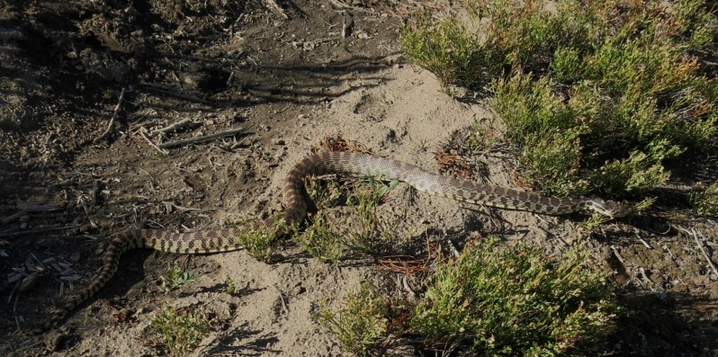
Janene really hates snakes. When in known rattlesnake country she always tries to make me take the lead on trails so I can be the one to set off the rattlers. Since we didn’t think this was rattler country, she was in the lead and got a good scare when she nearly stepped on this big four-foot rattler lookalike.
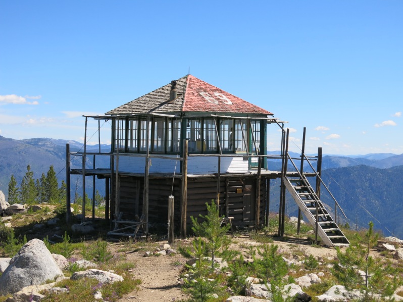
Home sweet home at good old #69 once again for our last night up in The Frank. 5,000′, all downhill, back to the lodge tomorrow. Unable to book an online reservation (that’s a joke) we had our hopes up that no one would already be staying here at the lookout. We had it all to ourselves.
So, Dear Reader, all told we hiked more than 70 miles, including more than 17,000′ up and 17,000′ back down. I fished at five lakes chock full of trout. Down below us 100-200 people per day per river launched their rafts for a “wilderness” float experience.
What was the final count in the “how many people will we see today” game? If you guessed zero, (that’s right , O ) then you win the fabulous prize: free beer. But to get the beer you have to come visit us in Boise.

Great photos Larry. Now the fish hat makes sense… you are a trout slayer.
Yes, Clay, the fish on that hat is a brook trout.
Enjoyed your Blog on the Butts Point, Cottonwood and Black Lake country. Really brought back memories for my wife and I, My wife Laurii painted the Outhouse logo originally back in 1973 as we were Butts Point Lookouts in 73 and 74. Before all the fires in that country. We hiked all the same places you did and we kept a daily diary for the two summers we were there. We had a pet Mule Deer buck we called John Deere we groomed him daily. We have hundreds of 35mm slides of the area. We had 2 visitors over 2 summers. Did you find see or find the CCC landing field near the trail south of the lookout? We knew you would see ZERO Humans!!!
Gary, I guess for the correct answer I’ll owe you a beer if you make it to Boise. The offer will stand if I find you in Stanley as well. We had heard of the old CCC landing field, but did not look for it.
LC
Larry, We really should get together sometime to reminisce over the Trail to and from Butts Creek Point. The two seasons wife Laurii and I lived and loved the Lookout life and all the time we spent going to Stoddard Lookout, Cottonwood Butte Black Lake, and Cold Meadows etc…..Awe such memories from back in 73 and 74,….And now I’m 73….and wanting to return to…
YOU GUYS DO A GREAT JOB OF DOCUMENTING YOUR BACKPACK TRIPS….MAKES ONE FEEL LIKE THEY ARE TAGGING ALONG WITH YOU….THAT TRAIL BLAZE YOU SAW WAS THE OFFICIAL FS TRAIL BLAZE CALLED THE TOE AND HEEL ,STARTING ABOUT 1905… I HAVE YET TO HIKE THAT AREA, BUT YOUR PICTURES MADE IT COME ALIVE…I CO-FOUNDED A FOUNDATION CALLED THE SELWAY BITTERROOT FRANK CHURCH TO TAKE UP THE SLACK WHERE THE USFS SAYS IT CAN NO LONGER CLEAR TRAILS…WE RECRUIT10 COLLEGE INTERNS ALONG WITH DOZENS OF WALK ON CITIZENS EACH SUMMER AND PUT THEM TO WORK…WE HAVE MORE DEMAND THAN WE CAN MEET WITH OUR LIMITED FUND RAISED BUDGETS…WE ARE NON-PROFIT, NON-POLITICAL, NON-ADVOCATE(NOLETTER WRITING) THE INTERNS ARE FORMALLY TRAINED BY US AND DO A 90 DAY TOUR…WE SPECIALIZE KEEPING THE PRIMITIVE SKILLS ALIVE THAT THE WILDERNESS ACT OF 1964 REQUIRES FOR OUR WORK….PEOPLE REALLY LOVE THE ADVENTURE OF IT ALL….OUR CEO IS SALLY FERGUSON WITH AN OFFICE IN BOISE, CHECK OUT OUR WEB PAGE AND STOP IN TO SAY TO SALLY…. I AM A RETIRED FOREST SUPERVISOR FROM THE NEZ PERCE NF, GRANGEVILLE, TOM KOVALICKY AND BELIEVE IN VOLUNTEERISM, BECAUSE THE AGENCIES HAVE LOST THEIR LEADERSHIP AND PASSION FOR KEEPING THE WILD IN IN WILDERNESS ALIVE EARL DODDS AND I GO BACK A SPELL AND SENT YOUR BLOG STUFF TO ME…I DID GUESS “ZERO PEOPE MET”SO I WILL BE LOOKING FOR THAT BEER, LIKE AN IPA, NO COORS OR BUDWEISER STUFF SELWAYBITTERROOT.ORG CHEERS TOM
Nice to hear from you Tom. Thanks for all the info. I’d love to chat with you over a beer of your choice some time.
I found a way in through the archives. No problem.
You are a regular hacker, Jon! Way to sneak in. I am honored that you would work so hard to see the blog. 🙂
When I got to the place where it says “read more of this post” I got an “oops” message saying nothing was posted. I would love to follow your many pictures through the Frank Church Wilderness. Could you resend that link. Thanks.
Lucky you to see a rubber boa! I am proud to say I ate a European Collared Dove yesterday (recent invaders in our area)
Mmm. That’s one way to get rid of invasives.
Well, Kiet, rest assured that there are plenty of us out West fighting to keep public lands in public hands. As opposed to Senators like Texas Ted who are on record that the federal government should get rid of all such lands. Efforts to divest public lands have come entirely from the Republicans. One day one the new Congress passed bills greasing the skids to get rid of federal public lands. But luckily for the public this is a non-partisan issue, and out West here it is one issue that everyone from the tree huggers to the Bambi hunters have untied on. We are fighting back. Bring your bike out West and spend some time riding on YOUR public lands.
Thanks for sharing your stories and the pictures. There’s really a lot to see in this beautiful country. I just hope it’s all still there belonged to the people a hundred years from now.