
This is Henry, aka Hank, Hanky Panky, or Hennie. Henry is a three year old German Shorthair Pointer.
 This is my good buddy Darin, Henry’s owner. I join Darin each August for salmon fishing at the mouth of the Columbia River. Henry no longer joins us in Darin’s boat, as he sometimes gets so excited when a fish is on that he jumps overboard.
 Waiting for the first bite one morning this August, Darin lamented that he had a crushing work schedule coming up, and was going to be unable to get out and do any hunting with Henry until late fall. Nice guy that I am, I offered to take Henry for a month or two and get him in hunting shape.
 Henry was happy to keep a close eye on the gas stove at our house in Boise when not out in Moby on hunting trips.
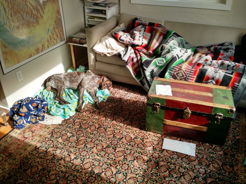 He was also happy to nap in the sun with Janene. Henry naps on top of his blankets, Janene under hers.
 If you want to drive the remote West, then Highway 95 is your route from Canada to Mexico. It runs south through the length of Idaho, cuts here across the SE corner of Oregon, down the entire length of Nevada, barely clips across California, and south through Arizona.

In order to reach Oregon’s most remote mountain ranges Janene, Henry, and I set off down Hwy 95 to McDermitt, Nevada, and then hit the gravel roads west back into Oregon. As you can see, this edition of Moby Goes will take you through a number of tourist destinations not found in that New York Times #1 bestseller “1,000 Places To See Before You Die.”
 From Hwy 95 you see the eastern front of the Oregon Canyon Mountains.
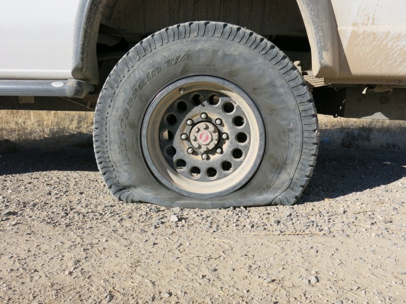 Faithful followers of this blog will remember our previous attempt to visit these mountains a year ago, only to be foiled by a flat tire. For those who missed it, check out that snafu in Moby Goes Back Home.
 Taking a break in our counter-clockwise tour of the Oregon Canyon Mountains, Henry and I found one flock of chukars near McDermitt Creek.
 Janene found a cougar footprint. Janene, aka The Safety Monitor, is always on the lookout for dangers.
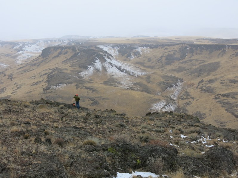
 Circling under the Oregon Canyon Mountains we cut north and soon the Trout Creek Mountains to the west came into view.
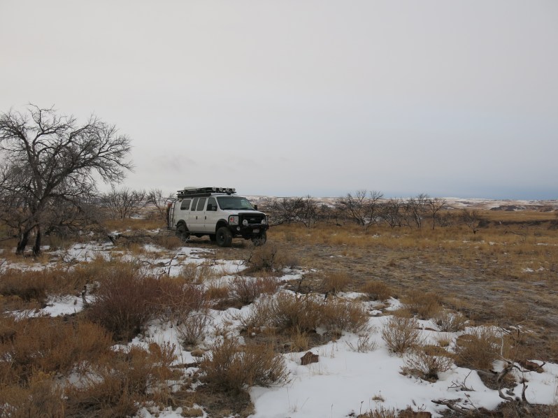
 As the sun set we found a place to camp in the midst of a burned out grove of Mountain Mahogany trees here at 6500’ elevation. Scorched a few years ago, this little grove is but one example of the ever growing fire problems here in the high desert brought on by climate change. Will there ever be summer shade here again?
 Strong winds at 18°F under gray skies made it a pretty bleak dawn. Not much traffic to disturb our sleep overnight though. In fact, we never saw another rig for two days on this part of the trip. Nor any tire tracks in the fresh snow. If you want away from the crowds this is the place to come.
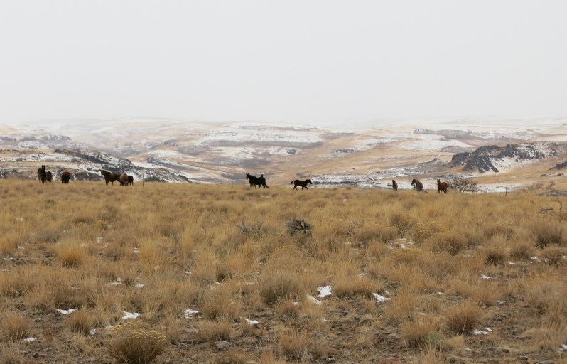 The below zero wind chill factor didn’t seem to bother these horses much.
 It was down coat weather for me as we hunted the breaks of Little Whitehorse Creek.
 Driving five miles north dropped us 1,500′ in elevation and out of the icy winds. But the number of chukars in this lower part of Little Whitehorse canyon was the same as the upper. A big fat zero. These tiny streams support a surprising large population of trout. An old buddy of my dad was a game warden with the state police in this region for thirty years. He just recently told me he long ago busted a guy here on Little Whitehorse Creek who had seventy-three trout in his bag. The limit back then was ten. Due to recent fires this and many other nearby creeks have been closed to all fishing as part of the recovery effort.
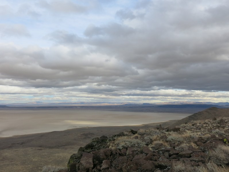 Next stop: the Alvord Desert. Not so much a desert as a huge playa (7 x 12 miles), Alvord Desert is as flat and usually as hard as a parking lot. It is a popular spot for racing around.
 Lovely little Alvord Hot Springs perches on the edge of the Alvord Desert.
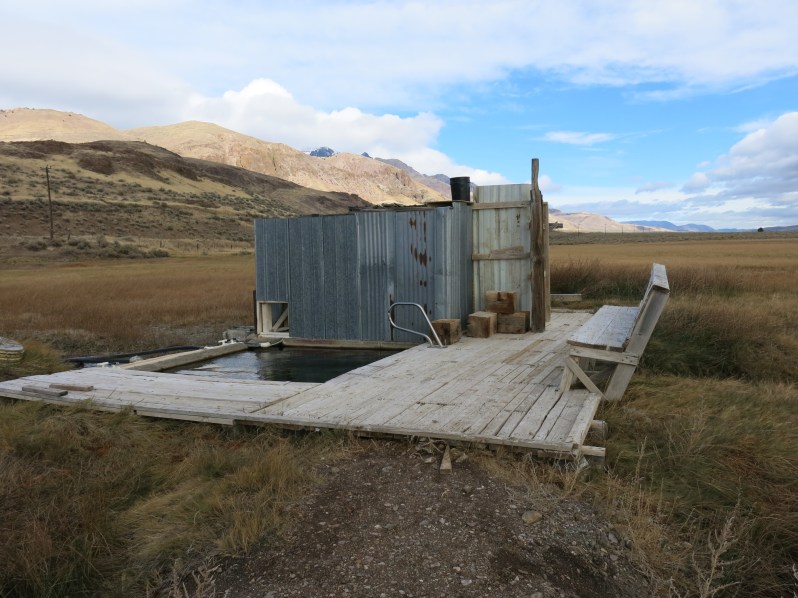 The primitive yet functional hot springs pool and shelter were constructed and maintained over the years by local ranchers. I first visited here in the 1970’s, and the bathhouse still looks pretty much the same.
 But Oregon’s population has doubled since since 1970, and finally with the social media information explosion, the hot springs were overrun with people. Located on private land, the ranch owner had always just let folks use the hot springs. With the crowds came conflicts, trash, and piles of human shit and toilet paper everywhere. Rather than put up “NO TRESPASSING” signs and close it down, the owner chose to start charging a fee for access and began developing things a bit. There is a bare bones campground now, and they brought in some funky Army surplus modular buildings that can be rented.
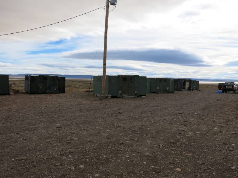
 The furnishings are rather Spartan inside these so called M.A.S.H. Units (Mobile Alvord Sleeping Huts). But in this place known for its howling winds, I recommend them over a tent. The night we stayed here we slept inside Moby, but from inside I could still hear the tent next to us flapping furiously all night long. Check it out at Alvord Hot Springs.
 The Alvord Desert averages 7″ of rain per year. But recent rains and snowmelt made the playa surface a bit soft. While it is legal to drive on it, I did not want five-ton Moby leaving ruts all over to ruin the smooth ride for others to come. But rocket dog Henry went for a high speed run,
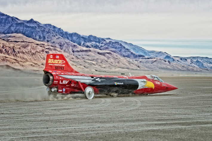 Henry was inspired by this jet car’s 2016 test runs on the Alvord desert. Drivers of cars like this definitely would be unhappy if Moby left big ruts on the hardpan.
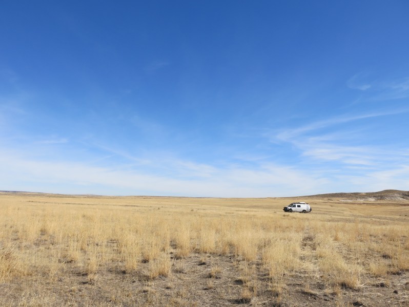
 The next morning we drove into the southeastern edge of Steens Mountain which overlooks the Alvord Desert. Moby could have made it further up the road, but to do so would have torn up the dirt track even worse that it already was. All too often out on these unpaved roads 4×4 driving morons churn and grind their way along just because they can. But in doing so they leave huge ruts, which make ugly driving for everyone else later, if not leading to permanent and worsening erosion damage. In my humble opinion they should get their lazy butts out from behind the wheel and try walking. This might seem a bit ironic coming from a guy who drives a massive 4×4 himself. But I see Moby not so much as a rig to reach remote places, but as a vehicle for living comfortably once I get to them.
 Pictured here is just a small portion of the 50 mile long, fault block Steens Mountain. While only 9,700’ high, the glacially carved Steens dramatically drop 5,500′ down to the Alvord Desert below. This high desert mountain range is stunningly beautiful, yet it is located so far from Oregon’s population centers that most Oregonians haven’t been here. Because Oregon is one of the few states with more immigrants than natives, most Oregonians probably don’t know the Steens exist. Yet it truly has national park quality vistas.
 We came across this cairn, which marks the general route for this part of the Oregon Desert Trail.
 This 750 mile route across the Oregon high desert is not an easy-to-follow, well-trodden , well-signed path like the better know Pacific Crest Trail. Instead it is an amalgamation of old roads, trails, and general routes marked with occasional cairns. If you want solitude, this is the trail for you. Check it out at Oregon Desert Trail.
 But Henry came to hunt, not sightsee. Thus his safety orange hunting vest. The vest is really more about visibility that safety or fashion. Without it he is well camouflaged in this desert vegetation.
 And here is Henry on point, holding still after having gotten close enough to a flock of chukars that they freeze in place. If all goes according to plan, he and they will remain motionless until I get close, and the birds flush into the air.
Henry’s job is to point the birds and then go retrieve them after I shoot. In this instance, all went as planned and I dropped two birds in two shots. The chukars can be seen as tiny black spots in the video if you look reeeeal close.
 Two chukars in the hand is worth a whole flock in the sagebrush.
 Guess which of these two chukars was retrieved by Henry? In the video you can see Henry racing after the first chukar that goes down. Soon after, I raced for the second rather than waiting for Henry to find it. This is due to the fact that Henry has what is known in the bird hunting world as a “hard mouth.” This is code for saying he chews the hell out of birds before returning them.
 The warm fall sun was lovely, and the chukars clucked their siren calls in the hills above. But the rain clouds began to look ominous.
 So we dashed back to Moby, lest the road down turn to a giant slip and slide. 4×4 will get you uphill. Nothing helps once you begin to slide downhill. Anti-gravity braking is not yet an option on any vehicle.
 We made it down and drove north before the torrents hit at sunset.
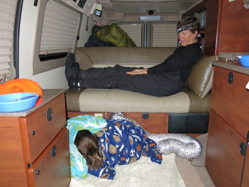 After a hard day’s hunt Henry can count on Janene to give him the platinum level treatment in Moby. Platinum level includes full blanket coverage, a personal heat vent, and premium dog food. I didn’t even know Rachael Ray made dog food until Janene went shopping for Henry. (And she claims she doesn’t like dogs.)
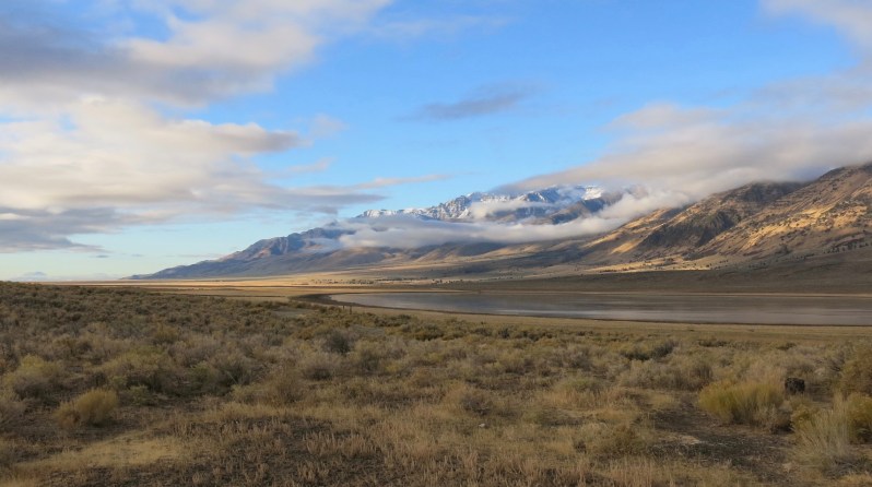 But all was lovely again in the morning light at our Mann Lake camp.
 A beautiful view in camp is always made better with a nice pit toilet. In our Moby travels we have high standards for scenery and isolation. Our need for fancy restrooms, however, is pretty low. So we consider accommodations like this to be quite fancy.
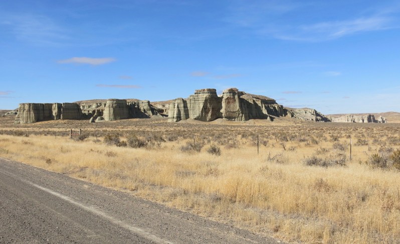 Heading back home, north on Hwy 95, we again passed through the tiny community of Rome. We took a slight detour down some gravel roads to see the town’s namesake, a local rock formation called the “Pillars of Rome.”

I think pioneering settlers here had a pretty vivid imagination to equate this with Roman architecture.
 No need to rush home. Our next side detour, to Jordan Creek, was off Hwy 95, out across public land administered by the Bureau of Land Management. We tried to get out here last year, but a local rancher had illegally locked a gate on BLM land, and showed up to run us off when we got to the gate. But after I contacted the BLM, they set him straight, and this time the gate to my public land, and yours, was unlocked.
 There is a movement in the West by reactionaries who want to turn federal land over to the states, resulting in a loss of public access. Find out more at #Protect Public Lands.
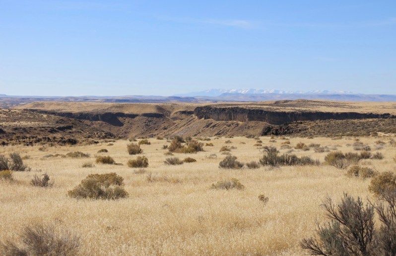 Snowcapped Steens Mountain can be seen in the background beyond Jordan Creek canyon. Most of what you see here is public land.
 The flat plateaus above give way to the deep canyon of Jordan Creek.
 No need to carry a water dish for Henry. In this land of lava rock I find a boulder with a natural depression that becomes Henry’s water dish. But this time the only one I could find was on the edge of this 100’+ cliff. Henry’s thirst clearly overcame his fear of heights. If he has any such fear.
 This rocky perch is clearly a favorite of raptors. They leave their white guano calling cards as they sit and shit and watch for prey below.
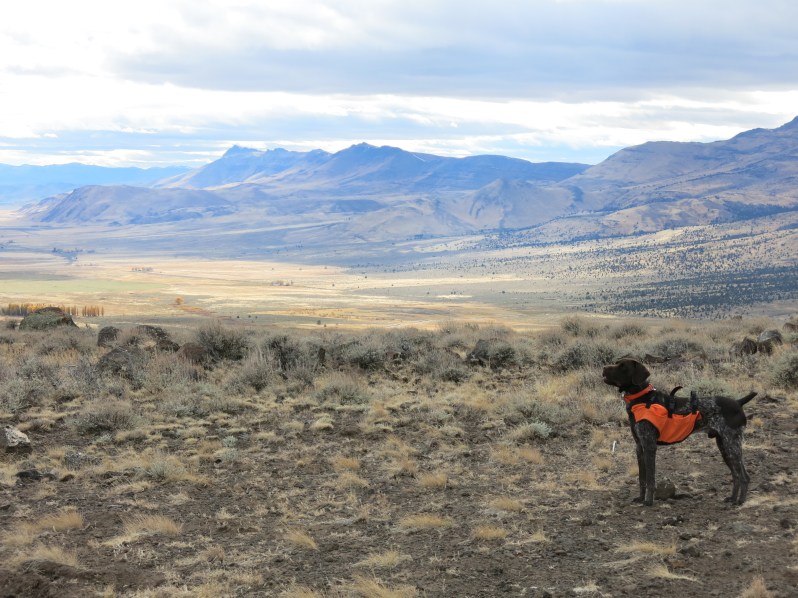
 For a pointer like Henry, nothing beats endless open space to run and search for birds.

Pure bliss.

Hi Larry. I love Hank. He’s a beautiful dog and reminds me so much of my dog as a child, her name was duchess. Hope your holidays are fabulous and that 2018 will be a wonderful healthy happy year for you. Blessings to you and Janine!
Get Outlook for Android
________________________________
Is that super quirky caretaker still living at the Hot Springs? He had a house that he had built out of an old RV. The whole thing looked like an art piece.
The shiny silver one? Nope, no longer there. Just a little modular thing now serves as the office/bathroom. Functional, but not at all cute or quirky.
That part of Oregon sure is nice— I once took my Honda civic wagon over the trout creek Mts. from McDermit —-Was a very slow go and had to keep my eyes on the “road” so I wouldn’t bust the rig up.
Shhh! Gary, don’t let people know that a Honda Civic (albeit it an all-wheel drive one) went up that same road. We want people to think only rugged monster trucks like Moby can make it in those places we show on the blog.
beautiful pics! full blanket coverage AND video!
Who knows, maybe next year you will see footage from a dogcam mounted on Henry’s head.
Awesome post, Larry! Love the adventure…I have to say I was a little jealous reading it…but I love what you find and do locally.
I made a mental note of the genius idea of taking a friends dog to “help him get into hunting shape”…well played.
You guys are always informative and inspiring…with a little flavor of E. Abbey that I love.
Hope to connect while we’re all in town.
Edward Abby? For a second there I was worried that I had posted a self-incriminating monkey wrenching photo of myself. But of course I never do that sort of thing, so why would I worry?
Great photos. Hankering for warmer chukar outings (today was frigid).